Retail News CRM

Tag: google maps

  • Revolutionize Your Navigation: Unveiling Google Maps’ New Gemini Features

    Revolutionize Your Navigation: Unveiling Google Maps’ New Gemini Features

    Google has recently introduced Gemini, a feature set to enhance the functionality and user experience of Google Maps. Users can identify if they have received the update by noticing a change in the microphone icon in the search bar at the top of the display. If it appears as a microphone, the Gemini update has not yet taken effect. However, if users see a blue sparkle icon within a circle, they now have access to the new Gemini capabilities.

    Gemini is replacing Google Assistant on Google Maps and is compatible with all forms of navigation available on the app, including driving, public transportation, cycling, and walking. Users can activate Gemini by uttering “Hey Google”.

    Gemini’s Features

    Gemini offers a range of features that can improve the functionality of Google Maps. Here are some examples:

    1. Basic navigation controls: Users can instruct Google Maps to “Navigate home”, “Stop navigating”, “Add stop”, “Mute guidance”, “Avoid tolls”, and “Show alternative routes”.

    2. Basic route answers: Users can ask for information about their route, such as “What’s my next turn?”, “When will I arrive?”, “What’s the weather like at my destination?”, and “What’s my next stop?”.

    3. Reporting issues: Gemini also allows users to submit reports about their route. For example, they can report “There’s traffic on the road”, “There’s construction up ahead”, and “There’s a car breakdown that’s causing congestion”.

    4. Search and get information about places: Additionally, Gemini can perform searches along the user’s route, find places near the user or their destination, refine search results, and add stops. For instance, users can request “Find me a cafe near my destination that serves tiramisu”.

    Questions & Answers

    What is Gemini on Google Maps?
    Gemini is a new feature introduced by Google to enhance the functionality of its Maps app. It is set to replace Google Assistant and offers a range of features like basic navigation controls, route information, reporting issues, and more.

    How can users tell if they have received the Gemini update?
    Users can identify if they have received the Gemini update by noticing a change in the microphone icon in the search bar at the top of the display. If they see a blue sparkle icon within a circle, they now have access to Gemini capabilities.

    How can users activate Gemini on Google Maps?
    Users can activate Gemini by uttering “Hey Google”. This will allow them to access all of Gemini’s features, including new navigation controls, route information, and more.
  • Navigate Your Holidays with Ease: Google Maps Unveils Four Exciting New Features

    Navigate Your Holidays with Ease: Google Maps Unveils Four Exciting New Features

    During the holiday period, traveling often becomes a necessity for many Americans, whether it’s by plane, train, or car. It’s a time synonymous with family gatherings, making it the ideal opportunity for Google to unveil some new updates for Google Maps. The company is rolling out four enhancements, all aimed at making your journey smoother and more informed.

    Pre-Travel Tips On Google Maps

    One of the significant updates is the addition of a feature dubbed “Things you should know before you go.” Google is incorporating AI capabilities into its applications, and Google Maps is no exception. When seeking directions to restaurants, hotels, or concert venues, scrolling down will provide users with key tips about the location. This is akin to having an expert guide providing you with insider knowledge.

    This feature utilizes reviews and other relevant information to provide essential tips – from how to make a reservation, to revealing secret menu items, and even providing parking advice to make your arrival hassle-free. Each tip can be tapped on for more details. The feature is currently rolling out for Google Maps on iOS and Android, with some users already reporting its presence on their devices.

    Enhanced Explore Tab in Google Maps

    Google is also revamping the Explore tab in Google Maps. A simple upward swipe in the Explore tab will now uncover trending dining spots, entertainment venues, and other points of interest. The feature is also designed to help users discover curated lists from trusted sources as well as local influencers. This update will be available on both iOS and Android devices within the month.

    AI-Powered EV Charger Availability

    For those driving electric vehicles (EV), Google Maps can already assist in locating an available charging station. However, the challenge lies in whether the port will still be available upon arrival. To overcome this, Google is using AI to analyze historical and real-time availability to predict how many chargers are likely to be free at your chosen charging station. This feature, accessible through a simple “EV chargers” search in Google Maps, will save users precious time and is set to roll out next week.

    Anonymous Reviews

    Lastly, Google is offering users the option to leave reviews using a pseudonym and a new profile picture tied to their reviews. This means users can share their experiences and recommendations without using their real names, providing a more comfortable way to leave feedback. Google assures that its built-in monitoring system remains in place to guard against fake and suspicious reviews. This feature will be available globally later this month on Android, iOS, and desktop.

    Questions & Answers

    What is the new feature in Google Maps called “Things you should know before you go”?
    This is a new feature that provides users with key information and tips about a location before their visit. It utilizes AI to generate this advice based on reviews and other relevant data.

    How is Google improving the Explore tab in Google Maps?
    Google is revamping the Explore tab to include trending dining spots, entertainment venues, and other points of interest. It will also showcase curated lists from trusted sources and local influencers.

    How is Google using AI to improve EV charger availability on Google Maps?
    Google is using AI to analyze historical and real-time availability data to predict how many chargers will likely be free at a chosen charging station. This feature helps users avoid wasted trips to occupied charging stations.

  • Google To Enhance Photo Access And Privacy In Messages App With Android 16 Update

    Google To Enhance Photo Access And Privacy In Messages App With Android 16 Update

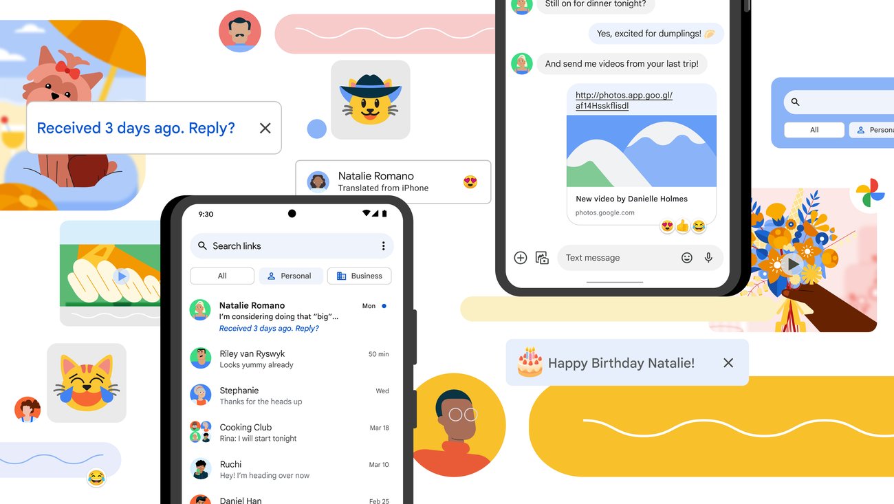
    Navigating to your photos in the Google Messages app for Android is simple, though it could be more streamlined. To begin, you’ll have to open Google Messages and select any prior message. A round button with a “plus sign [+]” icon is located to the left of the text input area. Clicking on this button reveals a range of options, including:

    – Gallery
    – Camera
    – GIFs
    – Stickers
    – Files
    – Location
    – Contacts
    – Schedule Send

    When you choose the Gallery option, the most recent images and videos stored locally on your device, as displayed by the Google Photos customized media selector, will be visible. However, if you need to access your photos via the Google Photos app using the Android System photo selector, you’ll have to press the Folders button situated at the bottom of the screen. This represents an additional step if you want to see the photos stored in the cloud rather than just on your device.

    Google is reportedly developing a solution to this issue, aiming to erase the additional step required to access your photos from the Google Photos app within Google Messages.

    Security and Access Concerns

    While the additional step may not bother some, it does raise a significant security concern. Google’s custom picker requires access to your full media gallery to function effectively. In contrast, Android’s photo picker allows applications to access only the photos and videos that you select. However, there is promising news — Google is said to be working on a way to allow users to access their photos from the Photos app via Google Messages without the need for the extra tap on the Folders button.

    New Developments in Android 16

    Android 16 introduces a new integrated photo picker equipped with its APIs, enabling apps to incorporate this photo picker directly into their interface. This provides app developers with a media gallery that feels native to their app, while also offering the security and privacy inherent in the Android system photo picker. This is because comprehensive media permissions no longer need to be sought. It was discovered that this embedded photo picker was present on a OnePlus 13 running OxygenOS 16.

    The Gallery button, when pressed, displays cloud-hosted photos and videos together with photos and videos stored on the local device. Before the introduction of the embedded photo picker with Android 16, users would have had to take the extra step and tap the Folders button to see their cloud-hosted photos and videos from the Google Photos app.

    Privacy Improvements

    Once the embedded photo picker is rolled out, there will be no need to grant the Google Messages app “Photos and videos” permission to share photos or videos. In fact, this permission can be revoked once the embedded photo picker is available.

    Questions & Answers

    What is the embedded photo picker in Android 16?
    The embedded photo picker in Android 16 is a new feature that allows apps to integrate a photo picker directly into their interface. This provides a media gallery that feels native to the app while also offering improved security and privacy.

    Does the Google Messages app require access to all my photos and videos?
    Currently, to function effectively, Google’s custom picker requires access to your entire media gallery. However, with the forthcoming embedded photo picker feature in Android 16, this will no longer be necessary.

    What is the benefit of the embedded photo picker?
    The embedded photo picker will eliminate the need for users to make an extra step when accessing cloud-hosted photos and videos from the Google Photos app. Additionally, it will enhance privacy as broad media permissions will no longer be required.

  • Google Maps’ New Landmark Integration: A Step Forward, Yet ‘open Now’ Filter Lacks On Active Routes

    Google Maps’ New Landmark Integration: A Step Forward, Yet ‘open Now’ Filter Lacks On Active Routes

    Google Maps, the popular navigational app, continues to evolve, recently following the lead of Apple Maps by integrating landmarks such as traffic lights and stop signals into its directional commands. Previously only providing distance-based directions like “turn left in a quarter of a mile,” the app now incorporates more specific and intuitive landmarks. For example, it may instruct users to “make a left turn at the next stop sign or the second traffic light.”

    Serving Beyond Navigation

    Google Maps proves useful beyond mere navigation. Once users reach their destination, the app can assist in locating amenities like restaurants, accommodations, entertainment venues, gas stations and more. However, not all of its features have been well received. Recently, some Reddit users voiced their annoyance with a particular search filter in Google Maps.

    Currently, the app offers a “Open now” filter when users search for specific places like “UPS near me.” This convenient feature allows users to see only results for locations that are currently open. But, the problem arises when users are already on an active route and want to add a stop. In these instances, there is no way to access and apply the “Open now” filter.

    Driving to Closed Locations

    Imagine this scenario: You’re driving and suddenly realize you could use a coffee pick-me-up. You recall a coffee shop en route to your destination and decide to add it as a stop, even though it may extend your travel time slightly. Upon arrival, you find the shop dark and the doors locked. The sign in the window tells you it closed an hour ago, well before you added the address to your app.

    The challenge lies in the fact that while a search result in Google Maps typically displays the hours of operation, this crucial information can be easily overlooked or blurred by the pressure of real-time navigation. As a result, users may find themselves unknowingly navigating to closed locations.

    Questions & Answers

    Why is the “Open now” filter feature not available while on an active route in Google Maps?
    As it stands, Google Maps does not currently offer the feature to filter for locations that are “Open now” while the user is on an active route. This limitation could be due to technical challenges or simply an oversight in user experience design.

    What happens when you add a stop to your active route in Google Maps?
    When you add a stop to your active route in Google Maps, the app updates your route to include the new destination. However, it does not currently provide you with the option to filter for locations that are “Open now.”

    What is the potential solution to this issue?
    A possible solution to this problem could be for Google Maps to make the “Open now” filter available and activated by default when users are on an active route. This would prevent users from inadvertently driving to closed locations and improve overall user experience.

  • Google Maps rolling out one minor UI change that should make it easier to use

    Google Maps rolling out one minor UI change that should make it easier to use

    Google Maps is now rolling out a set of new changes on Android phones, which aim to make the app easier to use and understand. One of the most notable ones is the use of “sheets” instead of full screens to further streamline the look of the app.

    These sheets are like smaller windows that pop up on top of the map. They have rounded corners and let you see more of the map while you’re using them. It’s a subtle change, but it makes the app feel less cluttered and helps you stay oriented while you’re exploring.
    Google Maps before and after the new “sheets” | Images credit — 9to5Google

    For example, if you look up a place, the information will show up in a sheet instead of taking over your whole screen. You can close the sheet with a tap or a swipe. And if you want to get directions, the tools for choosing your mode of transportation (like driving or walking) are now at the bottom of the screen, making them easier to reach.

    Google has been working on this redesign throughout the year. They tried it out earlier this year but made some changes based on user feedback. Now, the new design is finally being rolled out to everyone who has the Google Maps app on their Android phone. If you have an iPhone, you’ll have to wait a bit longer.

    These are all the key changes to Google Maps for Android that are currently rolling out:

    • Sheets instead of full screens for a cleaner look and better map visibility
    • Rounded corners on sheets for a more modern feel
    • Easier access to transportation mode options at the bottom of the screen
    • Redesigned interface for searching for directions
    This update is all about making Google Maps more user-friendly and doesn’t really introduce any new functionality. However, by simplifying the design and making things easier to find, the app should become more helpful, particularly when you are out on the road in a hurry. If you have Google Maps on your Android phone, keep an eye out for this update rolling out to the stable version 11.136.x.
  • Google Maps “Promoted Pins” feature that’s freaking everyone out is not new

    Google Maps “Promoted Pins” feature that’s freaking everyone out is not new

    When Anthony Higman, the person who first posted about the feature, was told the same, he was adamant that he did not tap anything, and the suggestion popped up on its own. The good news is that Higman said that the popup disappeared on its own in less than a minute.

    While it’s not clear if “Promoted Pins” can sometimes show up on their own, it’s a relief that they disappear after a while

    As X user Anthony Higman has shared, Google’s map app will not shy away from suggesting a quick detour to get you to visit one of the locations paying it to advertise on the app. Highman was asked to make a stop at Royal Farms, which is rated 2.9.

    Apparently, these hangouts are suggested arbitrarily and don’t have anything to do with your search history, which is how online ads usually work.

    As if we don’t already have enough ads all around us, be it billboards on the road or on websites we frequent, Google has somehow decided it’s a good idea to blast ads in your face when you are driving.

    Since the ads appear while you are driving, they are quite distracting and potentially dangerous. And from the looks of it, the popup doesn’t go away unless you tap on “Cancel” or “Add stop.” Given many people rely on audio instructions while driving, tempting them to interact with the screen could jeopardise their safety.

    A sponsored ad in Google Maps in the middle of your journey could potentially cause you to lose sight of where you were supposed to be going, especially if you are a new or inexperienced driver.

    Google seems to have lifted this bright idea from its subsidiary Waze, which is allegedly only supposed to show sponsored suggestions when your vehicle is not moving, but, as some users have observed, that’s not the case.

    It’s not known whether this feature is in testing or is here to stay. Higman has already declared that he will stop using the app if he gets sponsored suggestions every time he is driving. Not everyone hates the feature though, with one X user mentioning that it could be a good way to discover new places to go to.

  • Google Maps users will have to decide when they want Google to auto-delete Timeline data

    Google Maps users will have to decide when they want Google to auto-delete Timeline data

    Google is changing how it keeps your Google Maps location data. Once backed up using cloud-based servers, this information will now be stored on-device instead. An email sent by Google to Maps users says that they have until December 1st to save all of their old journeys on their devices before this data is deleted. Keep in mind that Google is changing the name of the feature you might know as Location History to Timeline.

    Timeline (formerly Location History) is a personal map that allows you to remember routes and trips you’ve taken and places that you’ve visited in the past so that you can visit them again. Instead of having all of this data connected to your Google account, it will be stored on your iOS or Android phone. This means that you will no longer be able to view your Timeline from the web starting in December. Moving this data on-device is supposed to improve the privacy of the information since it won’t be stores in the cloud.

    But as we noted, if you use Google Maps, you will have a decision to make. You have until December 1st to decide how long you want to keep your Timeline data on your phone. You can choose to keep all data on-device until you delete it yourself, or select to have the data automatically deleted after 3 months, 18 months, or 36 months. If you fail to make a decision by December, Google will move the first 90 days of your travel history to the first device you sign into Google with. Any data older than 90 days will be deleted.

    You can decide when you want Timeline data removed from your device automatically by opening the Google Maps app and tapping on the profile icon on the right side of the search bar on the top of the screen. Next, tap on Your timeline followed by the three-dot menu icon on the upper right of the display. From the pop-up menu that appears at the bottom of the screen, choose About timeline. Under the section marked Your choices, tap the link that says Go to settings.

    You’ll be sent to a page titled Activity controls. Look for the Auto-delete line that says underneath Choose an auto-delete option. There is a small arrow on the right side. Tap it and you’ll have two choices. One says Don’t auto-delete activity. Tap on that if you don’t want Google to automatically delete your Timeline data from your phone. Or, you can select the other option which says Auto-delete activity and choose to have Timeline data older than 3 months, 18 months, or 36 months deleted automatically. Tap the one you want and Google will automatically remove your Timeline data older than the choice you made.

    No matter what you select, Google allows you to delete any Timeline data from your phone manually.

  • Oft-requested feature is coming to Apple Maps with iOS 18 release later this year

    Oft-requested feature is coming to Apple Maps with iOS 18 release later this year

    With iOS 18 installed, Apple Maps users might be able to create their own custom routes, which they cannot do presently. Apple has pushed an iOS 18 file titled “CustomRouteCreation” to the back end of the Apple Maps app, and the title does give away plenty of information. But outside of the file name, all we know is that at launch, the feature will be limited to use in the U.S.

    Why would you want to create a custom route? Well, you might be used to taking a specific road and would prefer to travel on it, or a particular route might be more scenic or pass more bathrooms, or be near more shopping options or restaurants. Currently, Apple’s chief rival, Google Maps, has a process to allow users to create custom routes. This requires the user to employ his/her computer and then view this route on an iPhone. It sounds like Apple’s implementation is going to be much easier to use.

    It seems that iPhone users have been hounding Apple over the years to add this capability to Apple Maps. As far back as December 2020, Apple community member cowboyf16 asked in the discussions forum, “In Apple Maps, is there a way to create a custom route? For example, we like to drive scenic drives down multiple roads with no distinct destination.”

    We should get our first look at iOS 18 on Monday, June 10th during the WWDC 2024 Keynote. Shortly afterward, the public beta program for iOS 18 will start and you’ll have to decide whether to install it on your iPhone or wait until September when the final version of the software should be released. Keep in mind that beta releases are unstable and certain features that you rely on every day might not work at times if you install the iOS 18 beta.

  • Changes to the Google Maps UI should make you feel less cut off from navigating your journey

    Changes to the Google Maps UI should make you feel less cut off from navigating your journey

    In an effort to make Google Maps feel less cluttered, some changes are being made by Google to the app’s UI on Android now and iOS later down the road, so to speak. After all, when you’re driving on the road and you’re at a red light, you want to be able to take a quick glance at the Maps screen without other elements taking up your time or distracting you. One change can be spotted after you type in the name of a location that you want directions to.

    Currently, the screen is divided in two with the top half showing a map of the area surrounding the place you typed in. Underneath that, the other half of the screen has photos of the location you typed in and that sheet goes edge-to-edge. With the new UI look, the sheet at the bottom half of the app is no longer full-screen and it is slightly narrower at the top; there is another sheet behind it. When you pull the top sheet up, with the updated UI, you’ll be able to view a small section of the map at the top of the screen.

    It might not be a big deal, but with the change, you don’t feel completely cut off from the navigation map. And this is also the case with Public Transport as that sheet is no longer edge-to-edge at the top and it also no longer takes up the full screen.

    9to5Google reports seeing the new UI on one version of Google Maps (version 11.113.x), but this seems to be more of an A/B test since my Pixel 6 Pro is running version 11.115.x of Google Maps on Android 14 QPR2 Beta 3.2 and has yet to receive the new UI. The new look is also expected to eventually reach the iOS version of Google Maps, although it has not arrived on my iPhone 15 Pro Max running iOS 17.3.

    Some of you Google Maps users will consider this a nothing burger while others will bite into the UI changes like a quarter-pound sirloin burger.

  • Google Maps update finally adds weather information on Android

    Google Maps update finally adds weather information on Android

    Google’s apps don’t always offer the same features on iOS and Android, but the Mountain View company is trying to not keep any important functionality exclusive to just one platform for too long.

    In that regard, one of the Google Maps features that were only available for iOS users was the weather and AQI widget overlay that provided much-needed information in real-time.

    Now the feature is finally making its way to Android, 9to5 Google reports. The update is rolling out in waves, so you’ll know you got the feature if you see a small rectangular box in the app’s top-left corner.

    It’s a very small box that only shows the temperature and AQI (air quality index). However, you can tap on the box for more detailed weather information, including a 12-hour forecast. The AQI part of the small widget shows the existing Air Quality map layer if you tap on it.

    Keep in mind that if you select anything else in the app, the weather box will disappear. Apparently, this update has started rolling out to Android users for a few weeks now, but it’s only been recently that Google decided to expand its availability, so expect it to arrive very soon if you don’t have it yet.

  • Google Maps now allows users to find their favorite places faster using emojis

    Google Maps now allows users to find their favorite places faster using emojis

    With the Google Maps app, you can tap the Saved tab on the bottom of the screen to create lists of places where you want to go or your favorite places. Just the other day Google posted on its Google Maps’ X account that thanks to a new update to the app “you can customize your saved places with emojis to help you find your fav spots faster.” The emoji are the same ones available in messages so you can use a food emoji, a sports emoji, or any emoji you wish to symbolize a place that you’ve saved.

    To add an emoji, open Google Maps and press the Saved tab at the bottom of the screen. This won’t work with the default lists that come with Google Maps such as “Want to go,” “Favorites,” “Travel plans,” “Labeled,” and “Starred places.” You’ll have to create your own list or edit an existing one you created. In a video shared by Google on X, a new list named “Fav Coffee Spots” is created. Select an emoji for the list, which in this case is a cup of coffee, and add a description. Now, add the spots you want to add to the list.

    Once you’ve filled out the list, when you see one of these spots on Google Maps and are close to the location, you’ll see the name of the place with the chosen emoji next to it. If you zoom out on the map, you’ll see only the emoji. We assume that Google made this change because, unlike a pin stuck in a map, an emoji can convey more information to the user. Using emojis, you’ll be able to quickly determine if a certain spot on a map is one of your favorite coffee houses, a favorite ice cream parlor, or a burger joint you visit often without having to tap on the location.

    With so many emojis to choose from, the user can use them to find his/her favorite spots faster on Google Maps.
  • Google Maps will no longer show gas stations for EV drivers

    Google Maps will no longer show gas stations for EV drivers

    Google makes changes to its apps all the time and Maps is no exception to what seems to be an unwritten rule. Whether these changes are good or not for users, it remains to be determined. We can only hope that any anti-consumer decision will be rectified by the companies providing many of the services that we use.

    One of the important changes that will affect Google Maps for Android Auto in the not-so-distant future involves gas stations, which apparently will be removed for those who drive electric vehicles.

    Google has already confirmed the information, so expect this to be reflected in your Maps for Android Auto very soon. According to Google spokesperson Pearl Xu, “to help people get the most relevant information when navigating, last year we added the ability for EV drivers to see a shortcut for charging stations instead of gas stations on Google Maps for Android Auto.”

    The ability to see gas stations for EV drivers can be disabled in favor of the option to see charging stations since last year, but with the new change, Google Maps will no longer show gas stations as a category while navigating in an EV using Android Auto.

    If you’re using Google Maps for navigation purposes while driving an electric vehicle, you’ll soon notice that the top item will now show EV charging stations. In any case, here are some of the EV-specific features offered by the app, as highlighted by Google:

    • Real-time charging port availability: Just search for “ev charging stations” in Google Maps and you’ll see the real time availability of charging ports at nearby stations so you don’t have to wait in line.
    • Charging speed filters: The ‘very fast’ charging filter will help you easily find stations that have chargers of 150 kilowatts or higher. For many cars, this can give you enough power to fill up and get back on the road in less than 40 minutes. You can also use the “fast” chargers which will show you stations with chargers 50kW or higher.
    • Plug type filters: You can also filter for stations that offer your EV’s plug type so you only see stations with plugs that are compatible with your car.
    • Adding charging stops to trips: On any trip that’ll require a charging stop, Maps will suggest the best stop based on factors like current traffic, your charge level and expected energy consumption.
    • Charging stations in search results: We’ll also show you in search results when places like a supermarket have charging stations on-site. So, if you’re on your way to pick up groceries, you can more easily choose a store that also lets you charge your car there.
  • Changes made by Apple is making iPhone users switch back to Apple Maps from Google Maps

    Changes made by Apple is making iPhone users switch back to Apple Maps from Google Maps

    Apple Maps was something of a mess for a long time, prompting users to download Google Maps instead. Things are finally getting better though and iPhone owners are beginning to appreciate the changes that Apple has made to its maps app.
    Google Maps used to be the default mapping app on the iPhone and iPad but that changed after iOS 6 was announced. Apple Maps had many bugs including misplaced labels for landmarks and businesses and missing roads in cities. The user experience was so bad that Apple CEO Tim Cook had to issue an apology for the frustration it caused.
    Apple Maps has improved to the point that many people are sticking with it instead of switching to Google Maps.
    Changes such as an attractive design, clear public transit direction, faster routes, and better management of the unpredictability of subway outages than Google Maps is making people like Jason Rabinowitz who switched to Android to use Google Maps more easily come back to Apple’s ecosystem.
    Jane Natoli, who considers herself a Google Maps power user, says she has started using Apple Maps more after her iPhone prompted her to use the app in an airport. The app was able able to detect that she was at the airport and recommended shops and restaurants in her terminal. Natoli also liked that it had clearer information than Google Maps. She also thinks that it’s easier to read Apple’s find directions when compared to Google Maps.
    Georgia Tech graduate Angelica Nguyen says that roads are easier to look at on Apple Maps and the view is not cluttered by points of interest.
    Even though the iPhone comes preloaded with Apple Maps, most users have downloaded Google Maps as an alternative, according to Canalys. But Apple Maps is more deeply integrated into iOS and services that need direction use Apple Maps.
    People generally like to use default options, according to user-experience consultant Peter Ramsey. So now that Apple Maps has improved, people have no reason to download Google Maps.
    Google Maps is still considered the better option by some when they are driving. And Apple still has a lot of work to do. Costume-design student Laura Pladziewicz says that Apple Maps misguided her when she was in Boston. Law student Noah Abdelaziz said the app suggested a route that lengthened his commute.
  • Google unveils new useful features for Google Maps

    Google unveils new useful features for Google Maps

    Google is constantly looking to improve Google Maps. No longer just an app that helps you get from point “A” to point “B” quickly and safely, Maps will now recommend places to eat, hotels to stay at, and fun things to do when you arrive at point “B.” It will even show you landmarks to visit. And Google Maps will always show you where to get gas, a cup of coffee, groceries, and more.

    Today, Google announced some changes to its Maps app that make it more immersive when it comes to looking around to get the feel of a place or, as some call it, the lay of the land. Immersive view will combine Street View with aerial images and will show weather and traffic info on top to give users “a rich, digital model of the world.”

    Google gives us an example. “Say you’re planning a visit to the Rijksmuseum in Amsterdam. You can virtually soar over the building and see where things like the entrances are. With the time slider, you can see what the area looks like at different times of day and what the weather will be like. You can also spot where it tends to be most crowded so you can have all the information you need to decide where and when to go.”

    Continuing with the example, Google adds, “If you’re hungry, glide down to the street level to explore nearby restaurants — and even take a look inside to quickly understand the vibe of a spot before you book your reservation.” Immersive view starts rolling out today (displayed in alphabetical order) in London, Los Angeles, New York, San Francisco and Tokyo.

    Google’s AR-powered Live View takes a live feed from your phone’s camera and layers huge arrows and other information on top to help those walking get to their destination while at the same time, pointing out interesting buildings and landmarks around them. A couple of years ago, Google added Live View to indoor locations such as airports in the U.S., Zurich, and Tokyo (not displayed in alphabetical order). The feature helps travelers roaming an unfamiliar airport find the bathroom, car rental stands, lounges, and more.

    Today, the company announced that it will add Live View to 1,000 new airports, malls, and train stations over the next few months in Barcelona, Berlin, Frankfurt, London, Madrid, Melbourne, Paris, Prague, São Paulo, Singapore, Sydney, and Taipei.

    Search with Live View uses both AI and AR to help you find ATMs, restaurants, parks, and transit stations while walking. To activate it, hold the phone up while walking the streets. The info you will see is very useful as it will show you “when a place is open, if it’s busy right now, and how highly it’s rated – so you can make an informed decision and maximize your time.”

    Google recently started offering search with Live View in London, Los Angeles, New York, Paris, San Francisco, and Tokyo. Over the next few months, Google will add the feature in Barcelona, Dublin, and Madrid.

    Google Maps will soon give you “glanceable directions.” This will allow a user to track his journey from the route overview or the lock screen. You will see information like updated estimated arrival times and where you will make the next turn.  Previously, this data would only be shown once you unlocked your phone, opened the app, and used the comprehensive navigation mode. This feature will be disseminated to Android and iOS devices in the coming months.

    Google Maps is also adding new features for Electric Vehicles (EV) that have built-in Google capabilities. For example, on any trip that will require a stop at a charging station, Maps will recommend the best place to stop based on the current traffic, the current charge level of the EV’s battery, and forecast battery consumption. If the recommended charging stop is not convenient, it can be replaced with another upcoming stop with just a few screen taps. With this feature, EV drivers won’t have to keep worrying about stopping to charge regardless of the destination.

    EV drivers will also be able to tap the ‘very fast’ charging filter to find stations that use chargers of 150 kilowatts or higher. This should allow most cars to top off the battery and get back on the road in less than 40 minutes. And under search results, Google will now show when places like supermarkets have a charging station to help you pick up your groceries while charging the battery in your EV.

  • Google reiterates cool new features coming to Google Maps

    Google reiterates cool new features coming to Google Maps

    Google is teasing new features that are coming to Google Maps including Immersive View. Using a combination of Artificial Intelligence, Street View, and aerial images, this feature is designed to take you into an area that you’re planning to visit (using your phone’s screen), add the current weather and traffic, and even allow you to virtually enter a store or a restaurant. With Immersive View, you can get used to the restaurant you have reservations for and even know what to expect in terms of the size of the crowd.
    As an example, Google shows how Immersive View can show you what it will be like to view a ball game at Oracle Park. You’ll see in advance where the parking lots and exits are, see what the weather will be on the day of your visit (so you can dress accordingly) and allow you to take a virtual walk around the restaurants near the ballpark so you’ll know where to go to eat before or after the game.
    Immersive View will be available on Google Maps (on iOS and Android) over the next few months in Los Angeles, New York, San Francisco and Tokyo. It will also be available in more cities in the future. Earlier this year we wrote this about Immersive View: “If you want to know what the atmosphere is like inside a restaurant, with Immersive View, you’ll be able to swoop down to street level and get a peek of the inside of the eatery.”
    With Neighborhood Vibe, Google Maps can tell you what makes a particular neighborhood special. Is it an area for foodies? Is it an area with an “artsy vibe?” You can find out by exploring photographs of a particular neighborhood to see what it looks like.
    And using Search with Live View, Google bring Augmented Reality (AR) to your phone. You might be familiar with Live View which allows you to see arrows and directions on your screen layered over a live feed from your phone’s camera. Live View is used to navigate walks in certain cities using Google Maps. Search with Live View will allows you to search and find certain things in your area such as ATM machines.
    Chris Phillips, the VP and GM of Geo at Google told reporters, “You can also see coffee shops, grocery stores and transit stations. You really get a sense of what an area is like at a glance. You can even see the business hours of a place that’s down the street. It’s an amazing way to bring it all together at once, it really simplifies the experience and gives you confidence when you’re trying to see what’s around you in that moment.”
    Over the coming months, Search with Live View will be available in London, New York, Paris, San Francisco and Tokyo for both iOS and Android users. Google, which revealed many of these new features during its I/O developers conference in May, mentioned them again during its Search On 22 event held on Wednesday. Google also released a video of the event for those who might have missed it.
    Google is also allowing developers to include Google Maps eco-friendly navigation with their apps. This will allow food delivery or ride share drivers using Google Maps to help them navigate, take routes that are more fuel efficient. Developers will be able to allow users to select the kind of engine being used to make this feature even more fuel-efficient. This will be available later this year in areas where Google already offers eco-friendly routing such as in the United States, Canada and parts of Western Europe.
    These features will be coming to Google Maps during the coming months. The company says that they are part of its efforts to build a “visual-first” Maps experience so that users can more naturally navigate the world.