Tag: navigation

  • Revolutionizing Navigation: Google Maps iOS Update Autonomously Saves Your Parking Spot

    Revolutionizing Navigation: Google Maps iOS Update Autonomously Saves Your Parking Spot

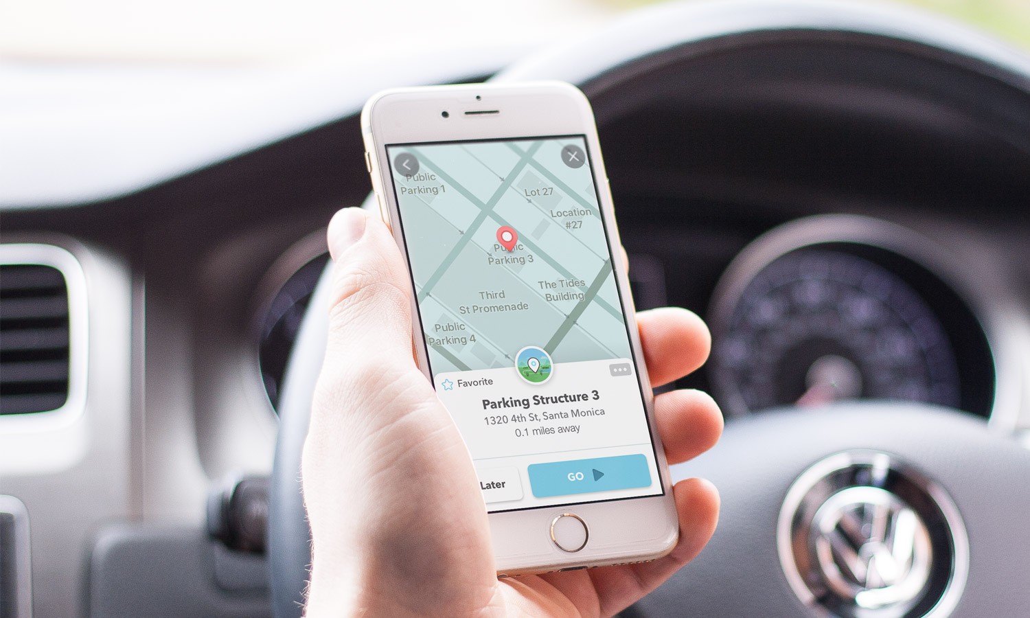
    Google Maps has introduced a new feature for iOS users: the ability to automatically detect and save a user’s parking location. This function eliminates the need for manual input, which was previously required on both mobile devices and Android Auto. The updated system now allows the app to identify when your car has been parked and saves the location accordingly. When you return to your vehicle and begin driving, the app will erase the saved location.

    Feature Availability

    As of now, this feature is exclusively available for iOS users and operates when your phone is connected to your vehicle and Google Maps. The connection can be established via Bluetooth, USB, or CarPlay. The saved parking location will remain on the app for 48 hours unless manually removed or if the car is driven.

    Personalized Parking Icons

    Google Maps’ Senior Product Manager Rio Akasaka disclosed the news on LinkedIn, though Google has not officially announced the feature. Additionally, Akasaka revealed an add-on to the feature: Google Maps will use your customized car icon to mark your parking location in the app. If you do not use a custom car icon, the default “P” icon will be used.

    As of yet, there has been no information released regarding when or if the feature will be available on the Android platform. The delay in introducing this function to Google Maps is surprising, given that similar features have long been available on other navigation apps like Waze and Apple Maps.

    A Timely Update

    Even though I’ve never experienced parking confusion quite as catastrophic as in the movie ‘Dude, Where’s My Car?’, I’ve had my fair share of difficulty locating my vehicle. This straightforward feature is a simple solution that could have been incorporated into the app sooner. However, its overdue arrival is still appreciated.

    Questions & Answers

    What is the new Google Maps feature for iOS users?
    Google Maps can now automatically detect and save a user’s parking location without requiring manual input.

    How does Google Maps connect with the car to use this feature?
    The connection between the vehicle and Google Maps can be established via Bluetooth, USB, or CarPlay.

    How is the parking location marked in the app?
    Google Maps will either use a user’s customized car icon or, in the absence of a personalized icon, the default “P” icon to mark the parking location.
  • Revolutionize Your Navigation: Unveiling Google Maps’ New Gemini Features

    Revolutionize Your Navigation: Unveiling Google Maps’ New Gemini Features

    Google has recently introduced Gemini, a feature set to enhance the functionality and user experience of Google Maps. Users can identify if they have received the update by noticing a change in the microphone icon in the search bar at the top of the display. If it appears as a microphone, the Gemini update has not yet taken effect. However, if users see a blue sparkle icon within a circle, they now have access to the new Gemini capabilities.

    Gemini is replacing Google Assistant on Google Maps and is compatible with all forms of navigation available on the app, including driving, public transportation, cycling, and walking. Users can activate Gemini by uttering “Hey Google”.

    Gemini’s Features

    Gemini offers a range of features that can improve the functionality of Google Maps. Here are some examples:

    1. Basic navigation controls: Users can instruct Google Maps to “Navigate home”, “Stop navigating”, “Add stop”, “Mute guidance”, “Avoid tolls”, and “Show alternative routes”.

    2. Basic route answers: Users can ask for information about their route, such as “What’s my next turn?”, “When will I arrive?”, “What’s the weather like at my destination?”, and “What’s my next stop?”.

    3. Reporting issues: Gemini also allows users to submit reports about their route. For example, they can report “There’s traffic on the road”, “There’s construction up ahead”, and “There’s a car breakdown that’s causing congestion”.

    4. Search and get information about places: Additionally, Gemini can perform searches along the user’s route, find places near the user or their destination, refine search results, and add stops. For instance, users can request “Find me a cafe near my destination that serves tiramisu”.

    Questions & Answers

    What is Gemini on Google Maps?
    Gemini is a new feature introduced by Google to enhance the functionality of its Maps app. It is set to replace Google Assistant and offers a range of features like basic navigation controls, route information, reporting issues, and more.

    How can users tell if they have received the Gemini update?
    Users can identify if they have received the Gemini update by noticing a change in the microphone icon in the search bar at the top of the display. If they see a blue sparkle icon within a circle, they now have access to Gemini capabilities.

    How can users activate Gemini on Google Maps?
    Users can activate Gemini by uttering “Hey Google”. This will allow them to access all of Gemini’s features, including new navigation controls, route information, and more.

  • Waze Unleashes Phone Access: Major Android Auto Hurdle Finally Overcome

    Waze Unleashes Phone Access: Major Android Auto Hurdle Finally Overcome

    Waze, the popular navigation application, is set to enhance its user experience on Android Auto by finally removing a significant hurdle that has been a point of frustration for many of its users. The app will now allow the use of phones while connected to the vehicle, aligning its functionality more closely with its direct competitor, Google Maps.

    Unlocking the User Experience

    Android Auto users who are fans of Waze have had a notably frustrating issue for some time. Upon connecting their device to their vehicle, the application would effectively freeze on their phone, often presenting a black screen or a banner urging the user to concentrate on the dashboard. This made the phone virtually impractical for entering directions. Fortunately, this source of exasperation is now being addressed.

    A widespread update is being rolled out that permits users to access and operate the Waze app on their mobile device while it concurrently runs on the car’s display. Although this feature has been seen in beta versions over the last few months, it now seems to be accessible to all in the stable builds.

    This enhancement has been anticipated for quite some time. Google Maps, a close cousin and rival to Waze, resolved this exact restriction back in 2023. Prior to this amendment, Maps users faced the same predicament of a ‘locked screen,’ a situation that was universally disliked.

    The Importance of This Update

    The significance of this update lies in the fact that in-car infotainment systems are often less responsive than smartphones. Inputting an address on a dashboard touchscreen can be clumsy, slow, and distracting. Older vehicles or specific models frequently rely on rotary dials instead of touchscreens, making the task of typing an address like ‘Main Street’ by scrolling through an alphabet wheel incredibly tedious.

    However, this alteration evens the odds. It enables a passenger to conveniently pick up the phone to add a stopover or check alternative routes without obstructing the driver’s map view on the larger screen. This update recognizes that the phone is often the superior input device, even though the vehicle may offer a better viewing experience.

    A Timely Improvement

    Many users, including myself, find themselves in a constant quandary over which of the two navigation behemoths – Google Maps or Waze – to choose. While Google Maps scores higher for its neater user interface and superior lane guidance, Waze is unmatched in its real-time police spotting and hazard alerts. Nonetheless, the inability to swiftly grab my phone and change a destination on Waze was a significant disincentive that often led me back to Maps.

    This update overcomes that obstacle. It makes Waze significantly less restrictive and considerably more contemporary. It’s a quality-of-life improvement that may sway me to consistently use Waze for my daily commute. If you are yet to see this feature in action, try force-stopping the app and reopening it while connected; this appears to activate the new pop-up.

    Questions & Answers

    What does the new Waze update entail?
    The update allows Waze users to access and operate the app on their phone while it’s simultaneously running on their car’s display.

    Why is this update significant?
    This update brings an end to the frustration of being unable to use the phone for navigation once connected to the car, a problem that had been a major issue for Waze users on Android Auto.

    Is this feature already available on Google Maps?
    Yes, Google Maps resolved this exact issue back in 2023, allowing users to operate the app on their phone while it’s connected to their vehicle’s infotainment system.

  • Google To Enhance Photo Access And Privacy In Messages App With Android 16 Update

    Google To Enhance Photo Access And Privacy In Messages App With Android 16 Update

    Navigating to your photos in the Google Messages app for Android is simple, though it could be more streamlined. To begin, you’ll have to open Google Messages and select any prior message. A round button with a “plus sign [+]” icon is located to the left of the text input area. Clicking on this button reveals a range of options, including:

    – Gallery
    – Camera
    – GIFs
    – Stickers
    – Files
    – Location
    – Contacts
    – Schedule Send

    When you choose the Gallery option, the most recent images and videos stored locally on your device, as displayed by the Google Photos customized media selector, will be visible. However, if you need to access your photos via the Google Photos app using the Android System photo selector, you’ll have to press the Folders button situated at the bottom of the screen. This represents an additional step if you want to see the photos stored in the cloud rather than just on your device.

    Google is reportedly developing a solution to this issue, aiming to erase the additional step required to access your photos from the Google Photos app within Google Messages.

    Security and Access Concerns

    While the additional step may not bother some, it does raise a significant security concern. Google’s custom picker requires access to your full media gallery to function effectively. In contrast, Android’s photo picker allows applications to access only the photos and videos that you select. However, there is promising news — Google is said to be working on a way to allow users to access their photos from the Photos app via Google Messages without the need for the extra tap on the Folders button.

    New Developments in Android 16

    Android 16 introduces a new integrated photo picker equipped with its APIs, enabling apps to incorporate this photo picker directly into their interface. This provides app developers with a media gallery that feels native to their app, while also offering the security and privacy inherent in the Android system photo picker. This is because comprehensive media permissions no longer need to be sought. It was discovered that this embedded photo picker was present on a OnePlus 13 running OxygenOS 16.

    The Gallery button, when pressed, displays cloud-hosted photos and videos together with photos and videos stored on the local device. Before the introduction of the embedded photo picker with Android 16, users would have had to take the extra step and tap the Folders button to see their cloud-hosted photos and videos from the Google Photos app.

    Privacy Improvements

    Once the embedded photo picker is rolled out, there will be no need to grant the Google Messages app “Photos and videos” permission to share photos or videos. In fact, this permission can be revoked once the embedded photo picker is available.

    Questions & Answers

    What is the embedded photo picker in Android 16?
    The embedded photo picker in Android 16 is a new feature that allows apps to integrate a photo picker directly into their interface. This provides a media gallery that feels native to the app while also offering improved security and privacy.

    Does the Google Messages app require access to all my photos and videos?
    Currently, to function effectively, Google’s custom picker requires access to your entire media gallery. However, with the forthcoming embedded photo picker feature in Android 16, this will no longer be necessary.

    What is the benefit of the embedded photo picker?
    The embedded photo picker will eliminate the need for users to make an extra step when accessing cloud-hosted photos and videos from the Google Photos app. Additionally, it will enhance privacy as broad media permissions will no longer be required.

  • Google’s Android Auto Enhances Driver Safety With Innovative Call Screening And Notes Features

    Google’s Android Auto Enhances Driver Safety With Innovative Call Screening And Notes Features

    Google has announced the implementation of new features to Android Auto, designed to augment safety and convenience for drivers. The recent update incorporates Call Screening and Call Notes, enabling drivers to handle calls in a more sophisticated way, without diverting their attention from driving.

    Call Screening in Your Car

    The latest update allows Android Auto to screen incoming calls, particularly from unknown or unsaved numbers, on behalf of the driver. When a call is received, the system prompts the caller to identify themselves and state the purpose of the call. The driver is then relayed the responses, providing them the choice to accept or reject the call without having to answer it manually.

    This innovative feature helps to deter unwanted interruptions while driving, ensuring that drivers only receive pertinent calls. By reducing distractions, it offers a smart safety solution.

    Call Notes: Keep Track of Key Points

    Android Auto plans to support Call Notes later this year. This tool automatically generates a summary of your calls in text format. It proves particularly beneficial for business or crucial conversations that cannot be recorded while driving.

    Call Notes was initially introduced with Google’s Pixel 9 phones. Now, by incorporating it into Android Auto, it aims to enhance productivity on the move.

    Why These Additions Matter

    These two enhancements offer tangible benefits for drivers:

    Reduced Distractions: Drivers no longer need to physically manage each incoming call while driving.

    Better Context: Call Notes enables drivers to capture key points from calls without the necessity of manually taking notes.

    Keeping Up with Competition: Apple’s iPhones already provide call screening within CarPlay. Google is maintaining its competitive edge by integrating this feature into Android Auto.

    Questions & Answers

    What are the new features introduced in Android Auto?
    The new features introduced are Call Screening and Call Notes, aimed at reducing distractions and improving convenience for drivers.

    What is the purpose of the Call Screening feature in Android Auto?
    Call Screening allows Android Auto to screen incoming calls on behalf of the driver. The system prompts the caller to identify themselves and state their reason for calling, giving the driver the option to accept or reject the call without manually answering it.

    What is the function of Call Notes in Android Auto?
    Call Notes is a feature that automatically creates a text summary of your calls. It assists drivers in keeping track of important points from calls without having to manually take notes.

  • Google Maps’ New Landmark Integration: A Step Forward, Yet ‘open Now’ Filter Lacks On Active Routes

    Google Maps’ New Landmark Integration: A Step Forward, Yet ‘open Now’ Filter Lacks On Active Routes

    Google Maps, the popular navigational app, continues to evolve, recently following the lead of Apple Maps by integrating landmarks such as traffic lights and stop signals into its directional commands. Previously only providing distance-based directions like “turn left in a quarter of a mile,” the app now incorporates more specific and intuitive landmarks. For example, it may instruct users to “make a left turn at the next stop sign or the second traffic light.”

    Serving Beyond Navigation

    Google Maps proves useful beyond mere navigation. Once users reach their destination, the app can assist in locating amenities like restaurants, accommodations, entertainment venues, gas stations and more. However, not all of its features have been well received. Recently, some Reddit users voiced their annoyance with a particular search filter in Google Maps.

    Currently, the app offers a “Open now” filter when users search for specific places like “UPS near me.” This convenient feature allows users to see only results for locations that are currently open. But, the problem arises when users are already on an active route and want to add a stop. In these instances, there is no way to access and apply the “Open now” filter.

    Driving to Closed Locations

    Imagine this scenario: You’re driving and suddenly realize you could use a coffee pick-me-up. You recall a coffee shop en route to your destination and decide to add it as a stop, even though it may extend your travel time slightly. Upon arrival, you find the shop dark and the doors locked. The sign in the window tells you it closed an hour ago, well before you added the address to your app.

    The challenge lies in the fact that while a search result in Google Maps typically displays the hours of operation, this crucial information can be easily overlooked or blurred by the pressure of real-time navigation. As a result, users may find themselves unknowingly navigating to closed locations.

    Questions & Answers

    Why is the “Open now” filter feature not available while on an active route in Google Maps?
    As it stands, Google Maps does not currently offer the feature to filter for locations that are “Open now” while the user is on an active route. This limitation could be due to technical challenges or simply an oversight in user experience design.

    What happens when you add a stop to your active route in Google Maps?
    When you add a stop to your active route in Google Maps, the app updates your route to include the new destination. However, it does not currently provide you with the option to filter for locations that are “Open now.”

    What is the potential solution to this issue?
    A possible solution to this problem could be for Google Maps to make the “Open now” filter available and activated by default when users are on an active route. This would prevent users from inadvertently driving to closed locations and improve overall user experience.

  • Waze pulls major reporting tool from iOS app and plans to replace it with Gemini

    Waze pulls major reporting tool from iOS app and plans to replace it with Gemini

    Waze users know that the directions offered by the app to a specific destination are enhanced by the data shared by the Waze community driving on the same road. Whether it is an accident, a slick road, heavy traffic, police activity, or weather, once the crowd-sourced data is shared Waze might change the route thanks to the new information it is presented with. There are multiple options that Waze users have to report this information.

    While most use touch input to report these issues, it is difficult to do while behind the wheel. Waze’s touch input can allow users to tap the on-screen button when spotting a hazard on the road and allow them to wait for a moment when the car is not moving to complete the submission. Another option that Waze users employ to report a hazard is Google Assistant. The digital assistant also was used to quickly arrange for navigation by asking it to navigate to your destination.

    The problem is that Google Assistant has never worked perfectly with the iOS version of Waze. This is the reason why Google is removing Google Assistant integration from the iOS version of Waze. Last week, a Waze staff member named Leigh wrote on the Waze discuss website, “We’ve decided to phase out Google Assistant on iOS…and replace it with an enhanced voice interaction solution in the near future. As always, we are committed to keeping you informed and will share more details as we progress.”

    Waze made it clear that Google Assistant “will continue to function seamlessly on Waze for Android, where it has consistently performed reliably.” While Google has yet to announce the “new voice interaction solution,” Waze will turn to Google’s Gemini AI for conversational reporting of hazards. This will allow Waze users to report issues using a more conversational style that will be less distracting for drivers.

    Here’s how this would work. Let’s say you’re driving and spot an accident on the road. You can press the reporting button and say, “So this crash is why traffic is such a nightmare.” This reports two issues with one quick sentence-the accident and the additional traffic causing a slowdown.

  • Google Maps will add this feature from Waze to make driving more colorful and fun

    Google Maps will add this feature from Waze to make driving more colorful and fun

    When Google bought Waze for $1.3 billion in 2013, it was obvious that it would move some of Waze’s crowdsourcing features to Google Maps. Over the years, Google has added many Waze-like features such as the ability to quickly report a crash, a slowdown, police activity, construction, a lane closure, a stalled vehicle, an object on the road, a flooded road, low visibility, and an unplowed road. All of these hazards can be reported in seconds.

    Now, Google Maps is adding another feature associated with Waze. The former will be adding new car icons to replace the blue arrow and other icons that can be used to represent your car on the navigation map. You can make this change on your iOS or Android-powered handset by pulling up the the menu from the handle near the bottom of the screen that shows how much time is left on your drive, the mileage remaining on your journey, and the estimated time of arrival. Grab the handle, swipe up and you’ll see a menu with several options.
    The next to last option reads Vehicle icon. Tap on it and you can select from the traditional arrow icon, a sports car, a pickup truck, an SUV, a sedan, and more for a total of eight icons. Just swipe through them to sell all of your choices. There are eight color options including:
     

    • Glacier white
    • Night black
    • Ash gray
    • Poppy red
    • Sky blue
    • Sunny yellow
    • Aqua green
    • Sunset magenta

    Another way to change your icon is to tap on the default vehicle icon that appears once you set your destination and start navigation. You must have the most up-to-date version of Google Maps on your iOS or Android-powered device to get this feature. One way to do this would be to tap on this link and install the latest version of Google Maps for iOS on your iPhone. If you own an Android device, press this link to install the latest Google Maps build on your Android phone.< Everything about the new car icons, from the way they look to the UI used to select your car and the color that you want the vehicle to be, looks like it just stepped right out of the Waze app. Google Maps and Waze have two separate functions. The former is for those who not only want to navigate quickly and safely from "A" to "B," but also want recommendations on where to dine, where to spend the night, where to find local entertainment, and more. Waze is more about the actual journey and using crowdsourced information that makes the drive easier to make.

  • Exciting Google Maps update adds new useful features

    Google is adding some exciting new features to the iOS and Android Google Maps app. Let’s say you’re looking for a winter sweater for the holiday season. Type winter sweater into the search bar at the top of the screen and you’ll see locations where you can purchase them. Starting today, this will work with home goods, electronics, and clothing. The information about where you can find, say, winter sweaters, shows stores that sell the item, ratings, the hours that the store is open, and how far it is away from you. You’ll also learn if the item is in stock.

    The update will also help travelers during the fall and winter by providing real-time updates on delays due to flooded roads and unplowed snow. With this feature, Google Maps users will be able to look for such issues and will be able to report such conditions. In addition, commuters and others will be able to report delays happening on bus or train routes to help riders stay up to date on any delays that would impact their travel.

    “Sometimes driving in unfamiliar areas with multiple lanes, forks, and exits can be confusing. To help you anticipate these, our enhanced navigation will show you lanes, crosswalks, and road signs clearly on the map. And because no one likes finding out they need to merge at the last minute, we’ll show you exactly which lane you should be in: Just follow the blue line in the lane markers while navigating.”-Google.

    Gemini is getting integrated with Google Maps. Why not? AI is everywhere and if you need some ideas on late-night activities for a guest staying over, simply ask Google Maps to look up “things to do with friends at night.” Gemini will send you some ideas along with reviews. Google has trusted data on 250 million places around the world along with info from the Maps community. Taking advantage of this data can help you enjoy a night out with a visiting friend.

    Google Maps is also making it easier to plan your drive before you even hit the road. Get directions to your destination, hit “add stops” and you will see top landmarks, attractions, and scenic spots to stop at along the way. And to make things even better, you can see dining options in advance.

    Another update will light up the destination on your screen along with an entrance into the building you’re traveling to. You’ll also be shown nearby parking lots and reminded to save your parking so that you won’t forget where you left your car. Once you’ve parked your car you can get walking directions to the entrance of your destination building by using Street View or AR walking navigation.

    Finally, Immersive View is getting an update. This feature uses AI to show you what navigation on certain routes, parks, and stadiums looks like at different times of day using AI, imagery, and computer vision. The weather expected on the day you are planning to visit will be taken into account. Immersive View is now available for 150 cities globally including Brussels, Kyoto, and Frankfurt. And college campuses are being added as well. Immersive View will now tell you where to park and when to expect a complex turn while you’re driving.

  • Waze releases emergency update for the iPhone version of the app

    Waze releases emergency update for the iPhone version of the app

    Google-owned Waze uses crowdsourced information to help guide you when you’re driving from point “A” to point “B.” Unlike Google Maps, which has become more than just a navigation app with mass transit information, restaurant reviews, entertainment, and lodging options, Waze uses a combination of real-time traffic info and reports from other “Wazers” to get you to your destination safely, and quickly.

    Waze users running the iOS variant of the app noticed something strange starting about a week ago. The app would lag when the user typed his destination in the “Where to?” field on the bottom of his iPhone. On Reddit, a Waze user with the username DependentDare4758 reported that Waze was sluggish on his iPhone 13 Pro Max running iOS 17.6. He wrote that he had to wait over three seconds to type in every keystroke on his iPhone, and that voice recognition was not operating.

    He also noted that scrolling was “exceptionally sluggish” when he was creating a trip for a later time and date. Additionally, highlights were all over the place covering two arrival times. This same Wazer pointed out that he was not having any of these issues using Waze on his fifth-generation iPad Air and sixth-generation iPad mini. Deleting Waze and reinstalling the app did not help.

    Several Redditors complained about this issue and now we have some good news to pass along. Waze developers have created an emergency update that fixes the issue. The update has started to rollout but is being sent in waves which means that it could be several days before the update arrives on your iPhone. You can look to update Waze manually by looking for and installing the update by following these directions:

    1. Open the App Store app and tap your profile icon in the upper right corner.
    2. On the bottom of the page you will see a list of apps that need to be updated.
    3. If all apps have been updated, swipe down a little from the top of the screen to refresh the page.
    4. Look for Waze and if you see it listed, tap on the Update button.

    Also, later this month, Android users will be able to see turn-by-turn directions, real-time traffic updates, and hazard alerts on their phone’s lock screen. Apple iPhone users should start to see this feature in the fall.

    If you don’t have Waze installed on your iPhone, tap on this link to download it from the App Store. If you’re using an Android device, tap on this link to install Waze from the Play Store.

  • Google Maps rolls out alerts for issues impacting accessibility

    Google Maps rolls out alerts for issues impacting accessibility

    Google Maps has just introduced an accessibility alert feature that will alert users of outages at public transit stations that could make it more difficult for those with disabilities to access these locations. The update is available on iOS, Android, and desktop devices. Initially, it’s rolling out in New York, Paris, Seattle, Boston, Budapest, and Brisbane.

    The alert feature will inform users of issues such as broken elevators, which could make it difficult for people in wheelchairs to access certain platforms. This information can be particularly useful for those who rely on accessible routes and want to plan their trips accordingly. For example, those who use wheelchairs, have strollers, or are carrying heavy luggage can use this information to avoid stairs.

    The update aims to enhance the inclusivity and usability of Google Maps by providing users with information about accessibility issues at transit stations before they arrive. It empowers users to make informed decisions about their routes and avoid unexpected obstacles.

    To access the accessibility alerts on Google Maps, users first need to activate the “wheelchair accessible routes” option. This can be done by following these steps:

    • Enter your desired destination in Google Maps.
    • Tap the three dots located in the upper-right corner of the app, next to the starting location.
    • Select “Options.”
    • Tap on “Wheelchair accessible.”
    Once this option is enabled, users will see alerts next to any route options that might have accessibility issues. Clicking on an alert will reveal more information about the specific issue. For example, users might see a notification about an elevator outage at a particular station.

    As technology continues to evolve, it is essential to ensure that it caters to the needs of all individuals. By integrating accessibility features into its platforms, Google is setting a positive example for the industry and working towards a future where technology truly benefits everyone, regardless of their abilities.

  • Google Maps “Promoted Pins” feature that’s freaking everyone out is not new

    Google Maps “Promoted Pins” feature that’s freaking everyone out is not new

    When Anthony Higman, the person who first posted about the feature, was told the same, he was adamant that he did not tap anything, and the suggestion popped up on its own. The good news is that Higman said that the popup disappeared on its own in less than a minute.

    While it’s not clear if “Promoted Pins” can sometimes show up on their own, it’s a relief that they disappear after a while

    As X user Anthony Higman has shared, Google’s map app will not shy away from suggesting a quick detour to get you to visit one of the locations paying it to advertise on the app. Highman was asked to make a stop at Royal Farms, which is rated 2.9.

    Apparently, these hangouts are suggested arbitrarily and don’t have anything to do with your search history, which is how online ads usually work.

    As if we don’t already have enough ads all around us, be it billboards on the road or on websites we frequent, Google has somehow decided it’s a good idea to blast ads in your face when you are driving.

    Since the ads appear while you are driving, they are quite distracting and potentially dangerous. And from the looks of it, the popup doesn’t go away unless you tap on “Cancel” or “Add stop.” Given many people rely on audio instructions while driving, tempting them to interact with the screen could jeopardise their safety.

    A sponsored ad in Google Maps in the middle of your journey could potentially cause you to lose sight of where you were supposed to be going, especially if you are a new or inexperienced driver.

    Google seems to have lifted this bright idea from its subsidiary Waze, which is allegedly only supposed to show sponsored suggestions when your vehicle is not moving, but, as some users have observed, that’s not the case.

    It’s not known whether this feature is in testing or is here to stay. Higman has already declared that he will stop using the app if he gets sponsored suggestions every time he is driving. Not everyone hates the feature though, with one X user mentioning that it could be a good way to discover new places to go to.

  • Waze launches feature that alerts you to a back-breaking, butt-flying change to the road you’re on

    Waze launches feature that alerts you to a back-breaking, butt-flying change to the road you’re on

    One of the reasons to use Waze for navigation is the community that is quick to share their recent driving experience over the same roads that you travel on. So if there is a pothole causing an issue on a road, you’ll know about it thanks to those who already suffered from driving over it.  The best way to understand Waze is to look at Google Maps and Apple Maps as the apps to use for the all-around experience of driving to a location, finding places to eat, where to stay, and how you can be entertained.

    Waze is more focused on the actual journey taking you from point “A” to point “B.” Once you get to “B,” Google Maps and Apple Maps can take it from there until you start on the journey back home. And now, according to autoevolution, Waze has started pushing out a new feature that we first mentioned to you a little over a year ago. This feature was one of the most requested features by Waze users back in 2020: Speed Bump alerts.

    If you’ve ever had the privilege of driving full speed over a speed bump, you’ll know the “thrill” of having the “law” of gravity briefly repealed as your rear end takes flight. In February 2023, a member of the Waze team said that Speed Bump warnings were coming to the platform in the near future. Last month, Waze said that it would soon inform users about “sharp curves, speed bumps, toll booths, and more.”

    Now that fellow Waze users’ Speed Bump warnings are being passed along to those using the app, I should be able to read the warnings and slow down as my car approaches a speed bump. This should save me from feeling the pain as my back, damaged with multiple levels of “severe” spinal stenosis, is jostled by the speed bump. And even if you do see a speed bump at the last minute saving you from speeding over it, that last second braking could result in the car right behind you plowing into the rear bumper of your vehicle.

    Not all speed bumps are showing up, but the feature is still in its early days. As we said, the speed bump alerts are part of a new update that includes sharp curves and toll booths. Waze also allows you to choose from a wide selection of voices to guide you over the roadways and you can even choose your own voice to guide you. If you use a phone running iOS, you can install Waze by tapping on this link. If you use an Android device, you can install Waze by tapping on this link which will take you to the Play Store.

  • Waze announces some cool new features designed to take the pain out of driving

    Waze announces some cool new features designed to take the pain out of driving

    There is a battle going on internally at Google. This battle is between mapping and navigation apps Google Maps, and Waze, both owned by Google. Google Maps delivers the total package getting you quickly and safely from point A to point B, and recommending where users should go to eat, sleep, and seek entertainment. Waze is more focused on the journey itself, offering crowdsourced information about traffic, weather, road conditions, police activity, road closings and more.

    Waze also has a bunch of cool features. For example, you can be given your turn-by-turn directions by a celebrity, or even have them delivered in your own voice! Many features on Google Maps start out on Waze so that they can be battle tested before moving on to Google Maps. With that in mind, Waze has announced some new features coming to the app. As Waze puts it on their web site: “Over the coming weeks, Waze is adding new features that will enhance your driving experience and provide more information about the road ahead. Get ready for safer, smoother drives!”

    New features coming include:

    Heads up on curves, bumps & toll booths! No more surprises! Waze now warns you about sharp curves, speed bumps, toll booths, and more. Stay informed and enjoy a smoother ride.

    Emergency vehicle on the road ahead. Get notified about emergency vehicles stopped along the road, giving you time to slow down and help protect first responders. Available now to drivers in the U.S., Canada, Mexico and France, with more countries coming soon.

    Say goodbye to sudden braking. Get alerts about speed limit decreases ahead, helping you to safely adjust your speed and avoid accidents, traffic jams, and even tickets.

    Your usual route, only better. Waze highlights your favorite routes for easy access and offers faster options if there’s traffic.

    No more driving in circles, literally. Navigate tricky roundabouts with clear instructions that show you the best lane to choose and where to exit.

    Stress-free parking is here. Choose the best parking spot! Compare rates, locations and amenities in advance and pick the best one. Soon, you will be able to reserve your spot from the app (currently available only in the U.S. and Canada).

    To add the Waze app to your iPhone, tap on this link to head to the App Store. Android users can install Waze on their phone by clicking on this link which will take them to the listing page for Waze in the Play Store.

  • Oft-requested feature is coming to Apple Maps with iOS 18 release later this year

    Oft-requested feature is coming to Apple Maps with iOS 18 release later this year

    With iOS 18 installed, Apple Maps users might be able to create their own custom routes, which they cannot do presently. Apple has pushed an iOS 18 file titled “CustomRouteCreation” to the back end of the Apple Maps app, and the title does give away plenty of information. But outside of the file name, all we know is that at launch, the feature will be limited to use in the U.S.

    Why would you want to create a custom route? Well, you might be used to taking a specific road and would prefer to travel on it, or a particular route might be more scenic or pass more bathrooms, or be near more shopping options or restaurants. Currently, Apple’s chief rival, Google Maps, has a process to allow users to create custom routes. This requires the user to employ his/her computer and then view this route on an iPhone. It sounds like Apple’s implementation is going to be much easier to use.

    It seems that iPhone users have been hounding Apple over the years to add this capability to Apple Maps. As far back as December 2020, Apple community member cowboyf16 asked in the discussions forum, “In Apple Maps, is there a way to create a custom route? For example, we like to drive scenic drives down multiple roads with no distinct destination.”

    We should get our first look at iOS 18 on Monday, June 10th during the WWDC 2024 Keynote. Shortly afterward, the public beta program for iOS 18 will start and you’ll have to decide whether to install it on your iPhone or wait until September when the final version of the software should be released. Keep in mind that beta releases are unstable and certain features that you rely on every day might not work at times if you install the iOS 18 beta.