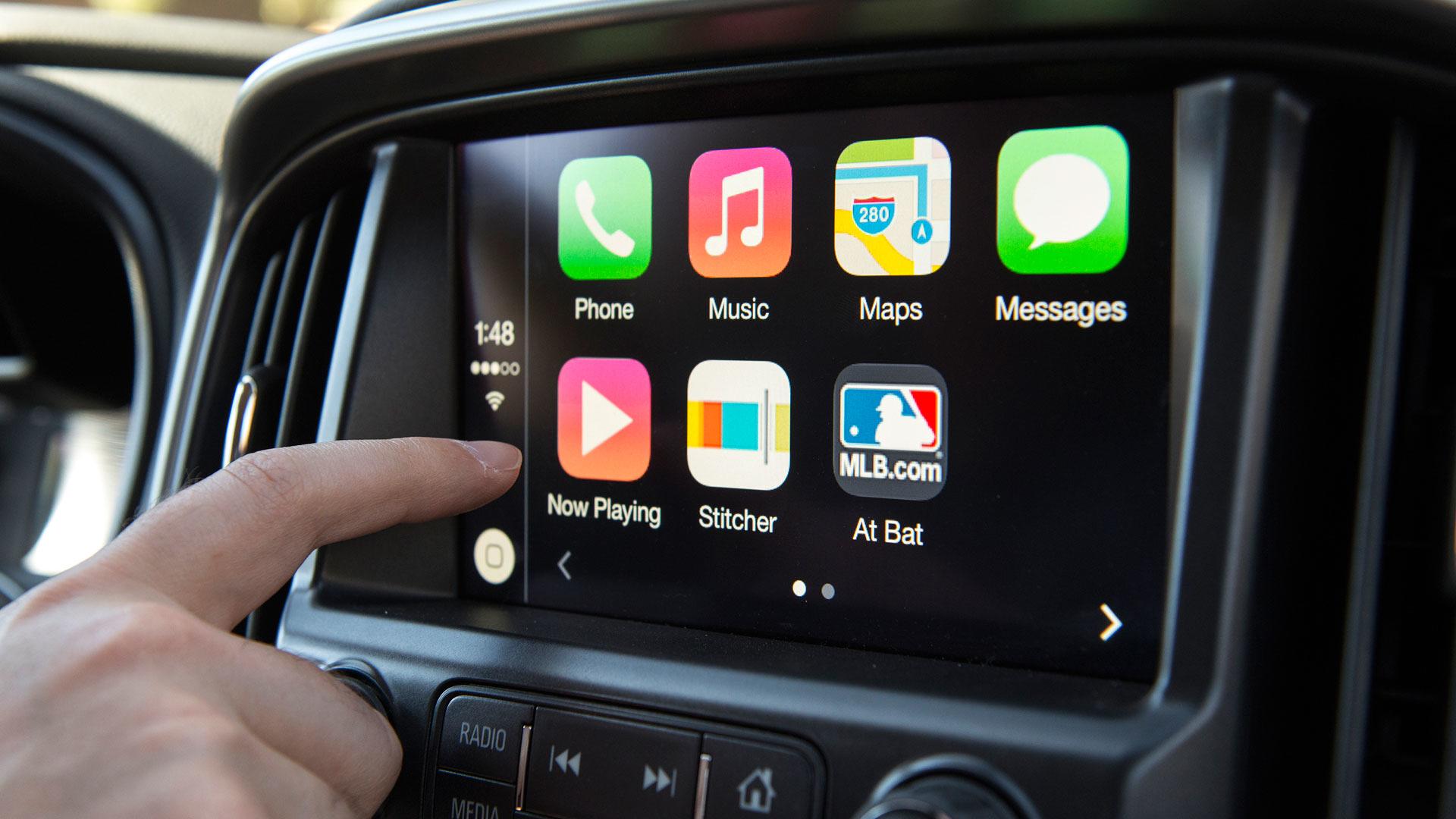
For example, let’s say that you prefer walking from place to place. If you drove the last time that you used Google Maps, that is the mode of transportation that will be selected whenever you open the app. If Google pushes out the aforementioned update, you can select walking mode and that will be the default setting every time you need Google Maps giving you some extra time to enjoy some of the fun activities that Google recommends that you partake in when you arrive at point “B.”
Tag: navigation

Google Maps bug prevents useful feature from working perfectly
Google Maps has a location-sharing feature that allows you to share your location with others. Users can set a time limit that shuts down this peek at your current location after the set time period has been reached. Or, the user can decide to keep this information available by choosing the setting that shares the current location “Until I turn it off.”
However, it appears that there is a problem, and some Google Maps users on the app’s support page are complaining that they are no longer able to select the “Until I turn it off” option. This bug is preventing Google Maps users from allowing someone to continue to monitor their current location until they turn off the location sharing feature.
A member of the Google Maps support page, Loes Frank, wrote, “Hi! I am sharing my location for a long time with my parents and brother. Always ‘until I turn it off’ instead of a limited time. For a while I shared my location with my boyfriend without a time limit but it suddenly doesn’t work anymore.”
Loes continues, “I am still sharing my location with my family without a time limit but with my boyfriend it’s impossible. Also with new people, it’s impossible. How can I fix this?” In other words, she complains that the option to keep sharing her location until she’s done is still showing up on her phone, but it is not working when she presses on it.
A Google Platinum Product Expert tried to blame the problem on Loes’ lack of verification which he says prevents Google from knowing her age which blocks her from using “features like enabling location history and browsing your Google Timeline. These features are only available for users whose accounts have been verified to meet the minimum age requirements.”
But the expert was quickly proven wrong when another Google Maps user wrote, “This is happening for me too, no option to verify the account so it’s already verified. On other family members’ phones they can still see the option saying ‘until you turn it off.’ Any ideas, Google?”
And another post in the Google Maps support page says, “My fiancés’ phone has been sharing locations with me for years and it stays on, on my phone, but every day his location sharing is set to ‘until I turn it off.’ When he gets near his own home maps, location disconnects yet he can see mine when neither one of us touched it.” The location-sharing feature is a handy tool for those who would like to be tracked as they travel just in case a situation arises where they need help.
Every person complaining about this issue says that Google Maps runs perfectly on their device with the location sharing issue the only problem that they are having with the navigation and mapping app. The problem started earlier this month and this timing has led some to believe that the bug was introduced via a recent software update. Whatever the cause of this issue, it seems to prevent the ‘until I turn it off’ option from working with certain contacts.
Google continues to work on Maps as it continues the evolution of the app which started as an application tasked with getting users from point “A” to point “B” safely, and in the fastest possible time. Besides additions to the navigation part of the app that warn you of delays, accidents, speed traps, tolls, and speed limits, Google Maps now helps you find places to eat, places to see, hotels where you can stay and famous landmarks to visit once you get to “B.”

Waze survey: more than 50% of Americans would quit their jobs for a shorter commute
Waze’s days of being just a simple navigation app are long gone. Today’s Waze is a fully automated companion for drivers all around the globe that not only provides navigational directions, but also entertainment (in many forms). And since there are so many people using Waze while driving, wouldn’t be interesting to know what they’re using the app for?
Today, Waze released its first-ever Year in Rear View survey, which puts US driving behaviors from 2021 under the spotlight. Using first- and third-party data, the navigation app is taking a look back at its year in travel to see the places where Waze users drove the most, the books and music that were listened to the most, as well as other interesting habits.
The full survey includes data from Waze users in the US, Canada, UK, France, Italy, Israel, Brazil, and Mexico, but we’re going to take a look at how US drivers made use of the app throughout the year.
What behaviors, trends or quirky habits did drivers showcase in 2021?
- 60% of global respondents are happy drivers, rating themselves 8 or above (out of 10). Drivers in Brazil and Mexico were ranked the happiest drivers, while drivers in the U.S. scored 7. In the US, 35–44-year-olds are the happiest drivers
- Brits are known for being polite, so it’s no surprise 60% would wait patiently if a car ahead of them wasn’t moving. Meanwhile, 35% of Americans are more likely to honk their horns to get moving!
- Shopping was the main reason 43% of Americans used their cars in 2021, with visiting family (36%) and commuting to and from work (36%) following behind
- Older Americans are more confident parallel parkers: while 33% of 18–24-year-olds refused to parallel park, only 8% of those 65 and over said they wouldn’t
As far as entertainment goes, the results are totally unsurprising, especially when it comes to drivers in the United States.
What kept drivers entertained this year?
- Sweets and candy were the top snack of choice for drivers across the globe, except in the U.S. where drivers prefer fast food as their favorite snack
- U.S. drivers felt that “Easy on Me” by Adele, “Leave the Door Open” by Silk Sonic, and “Peaches” by Justin Bieber featuring Daniel Caesar and Giveon best reflected their year on the road
- Podcasts are a more popular option for younger American drivers with 45% of 25–34-year-olds choosing this entertainment, compared to 20% of 55-64-year-olds
- Globally, those listening to podcasts used their time to stay informed with NPR News Now, The Daily, ABC News Briefing, Times News Briefing and Sur Le Fil ranked as the top podcasts drivers listened to on Spotify via Waze
- 45% of 18–24-year-olds in the U.S. would give up their phones if it meant a year with no traffic; while 38% of 65-year-olds and over wouldn’t give up anything to avoid traffic
Most Waze drivers would have Elon Musk ride with them
The survey also reveals that James Bonds’ Aston Martin was the top car of choice for North American drivers with 32% of users choosing the muscle car. Jennifer Lopez and Elon Musk were the top female and male celebs who made headlines this year that drivers across the globe would most like to have in their passenger seat, yet US drivers would rather have Beyonce and Elon Musk or Joe Biden riding with them.
Here is something very interesting though: more than 50% of US residents would quit or change their jobs just to benefit from a shorter commute. Also, carpooling remains the best option to avoid traffic with Americans (39%) more likely to share their journey with a friend or colleague to avoid traffic than drivers in other countries.
Finally, Waze’s survey also contains data bout US cities where the app’s users drove the most this summer: New York, Los Angeles, Washington, D.C., Chicago, Houston, Boston, Philadelphia, Atlanta, Dallas, and Nashville.

Waze blames a glitch for sending drivers into dead end roads
Back in late October, we told you that Google-owned mapping and navigation app Waze was giving drivers the wrong directions and sending them right into the heart of traffic jams. Waze CEO admitted that “We have a problem with the algorithm. The more people we serve, the more it’s affected. The coronavirus has put us in a situation where we have to reinvent our algorithm.”
Those problems that Waze was having were affecting their Israeli users. Now, according to road.cc, Waze is having problems directing users in the U.K. through the Royal Parks of London. A tweet sent from the charity to Waze said that it “would like to talk to someone about several of the reasons you [sic] we’d prefer you not directing drivers down closed roads in a park, what’s the best way to reach you please?”
The tweet included a screenshot from Waze that showed the app directing drivers through Richmond Park. Waze at first said that it would look into the matter, and eventually, it acknowledged that it routed drivers through closed roads. While the company said that it wasn’t sure why it happened, it added that it wasn’t seeing any issues with routes at that moment and wondered whether the earlier problem was nothing more than a temporary glitch.
Social Media users did what social media users do best; they criticized both Waze and The Royal Parks for not doing everything that they could to end the problem. The Department of Parks & Recreation told The Royal Parks: “We welcome your engagement with routing providers, although we think you should tell the providers not to route through the park at all.”
Richmond Park, the subject of the initial tweet, is known for hosting cyclists leading Merton Cycling Campaign to complain to The Royal Parks, “You’re enabling this. You own the problem. Just close the gates to through traffic as responsible stewardship of a national nature reserve during a climate emergency requires.” Another tweet from a “Marty Velo” also blamed The Royal Parks and said, “why have you guys not tried to get in touch with them since the app was released years ago? It’s a bit late now, isn’t it? The parks are overrun with dangerous rat-running drivers.”
And yet another tweet, this one disseminated by Madeleine Baines, showed directions inside the same park from Google Maps and the latter also navigated users to closed routes.
Waze started life as a crowdsourced navigation app that depended on the Waze community to inform users about accidents, traffic jams, police speed traps, and more. After Google bought Waze in 2013, many questioned why Google would make the deal considering that Google Maps was (and still is) the most popular mapping and navigation app. But over the years Google took some of the most innovative features from Waze and added them to Google Maps.
For example, back in August Google Maps started showing the cost of tolls on bridges and roads that are crossed as part of the user’s journey. This came from Waze as did incident reporting. This was one of the first features that Google added to its Maps app and it came just months after the acquisition of Waze was announced by the gang at Mountain View.
Six years later, Google announced that Google Maps users could report slowdowns on their journey from “A” to “B” along with crashes and speed traps. Waze still has some popular features such as setting up the app to give you turn-by-turn directions in your own voice.

Dark Mode arrives on the iOS version of Google Maps
Back in August, Google announced that the iOS version of Google Maps was getting Dark Mode. The feature has been available since September. We should point out that if you set your iPhone to system-wide Dark Mode by going to Settings > Display & Brightness and tapping on Dark, Google Maps will not go to Dark Mode. So if you want the app to run on the latter, follow these directions.
Open Google Maps (which goes without saying although we just said it anyway, didn’t we?). Tap on the circle with your profile picture or first initial in it located on the right side of the Search bar at the top of the screen. Tap on Settings and under the USING MAPS headings, you’ll see a listing for Dark Mode.
When you tap on Dark Mode, it will open a page with three options: On, Off, Same as device setting. Tap on On and the entire app goes into Dark Mode immediately. Menus that have black text on a white background will show a black background with white text which isn’t as likely to burn a hole in your retina as that intense white background is.
Tap on Off and Dark Mode will not turn on at all. The last option is the Same as device setting. This means that the app will follow the settings you have chosen for your iPhone. Using Dark Mode reduces the strain on your eyes, makes the screen easier to read, and if you have an AMOLED display, it can save battery life.
Since an AMOLED display doesn’t require a backlight, the color black is created by turning off the appropriate pixels.

Full dark mode is finally coming to Waze
Back in 2013, Google purchased Waze for a reported $1.3 billion. While the company already owned the leading mobile navigation app in the world, over the years Google has taken some of the features that made Waze popular such as its crowd-sourced traffic information and used it to improve Google Maps. At last count, the app has over 134 million monthly active users worldwide and last year it was the second most popular mapping app in the world.
Waze makes money by running ads from 25,000 businesses that want to reach their customers locally. A company paying $60 per month will reach an estimated 30,000 Waze users while laying out $30,000 per month will allow a company to reach as many as 1.5 million Waze users.
Waze is rolling out an “alpha” version of the app with a full dark mode to a limited group of users; this is a special build of version 4.78 with a version of dark mode that the public doesn’t see. Currently, dark mode on Waze covers just the map itself. With the update, dark mode will cover all of the app including settings and the rest of the app.
Right now, the “alpha” version of the update is considered buggy which indicates that Waze and Google have a lot more work ahead before the final version of the update is disseminated. In dark mode, instead of using dark text on a white background, white text is used on a dark background. This keeps users from getting blinded by the piercing white background which can be dangerous when using the app at night while driving.
Google finally started disseminating a full dark mode update to Google Maps earlier this year after it had talked about it for a year. Thus, there is no reason why Waze couldn’t join its stablemate, and it will, once the bugs in the “alpha” build are exterminated.
If you want to enable dark mode on Google Maps, tap the profile picture in the upper right corner of the screen, tap on Settings, and underneath the USING MAPS heading, you’ll see Dark Mode. Tap on it and you’ll have three options: On, Off, or Same as device setting.
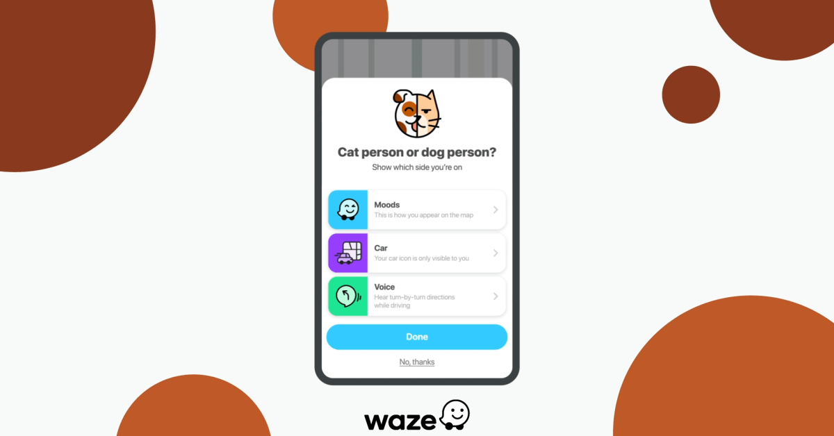
Waze says that it will not offer any setting that allows the maps to be dark and the UI light or vice versa. This news comes right after Waze launched what it calls the “headspace” experience designed to reduce stress while behind the wheel. Instead of the automobile icon, using this feature shows you in a hot air balloon as you listen to one of five different mood themes: Aware, Bright, Hopeful, Joyful, and Open.
Drivers will also be able to stream a customized Spotify playlist with music and content from Headspace. You won’t find that on Google Maps, nor will you see the community that Waze has built on other navigation apps. In the past, Google and Waze each have said that they do not share traffic data with each other and despite being owned by Google, Waze has pretty much acted as though it was still an independent company.
Waze has its own community forum where users can make suggestions. You can install the app on your iOS or Android phone by visiting the App Store or Google Play Store respectively.
Among the features seen on Waze that Google Maps users will soon see is one that will show the tolls that drivers will need to pay to cross bridges, and certain roads. Members of the Google Maps.

Waze launches soothing experience to combat negative effects of driving
We live in a world where driving has become an activity that often affects our mental health. Traffic is probably in top three reasons for stress, and can many times lead to much worse effects, including back pain, depression, and even blood pressure.
To help combat these negative effects of driving, Waze launched a new Headspace experience that is meant to help drivers learn “how to find more joy and meaning on the road.” Headspace is a new Waze theme that provides users with custom navigation prompts from the mindfulness teacher and Director of Meditation, Eve Lewis Prieto.
There are five moods that can be selected when listening to the Headspace experience: Aware, Bright, Hopeful, Joyful, and Open. Also, the new theme allows users to swap out the in-car icon with an air balloon.
Equally important is the fact that drivers can stream a custom Spotify playlist with music and content from Headspace, which is also available via the Waze Audio Player. The Headspace experience is rolling out today and is available for a limited time in English, French, Spanish, and Portuguese.
If you’re looking for a soothing driving experience, you can activate the new theme by tapping My Waze to find the “Drive with Headspace” banner.

Google Maps faces a new Russian rival on Android Auto
Earlier this spring, Google made the smart move to permit its Android Auto app-mirroring dashboard display software to become compatible with third-party apps. This was after it was fined $123 million in Italy, for its monopolistic actions in refusing to allow Italian navigation app JuicePass (which directs electric vehicle drivers to the nearest charging station) access in favor of Google’s own Maps app.
Once the gates were open, naturally, there was an influx of navigational and other car experience-enhancing apps rushing in to compete with Google’s native navigational offerings. It was finally all healthy, fair competition, and Russia has joined the fray with one particular recent candidate: Yandex.Maps.
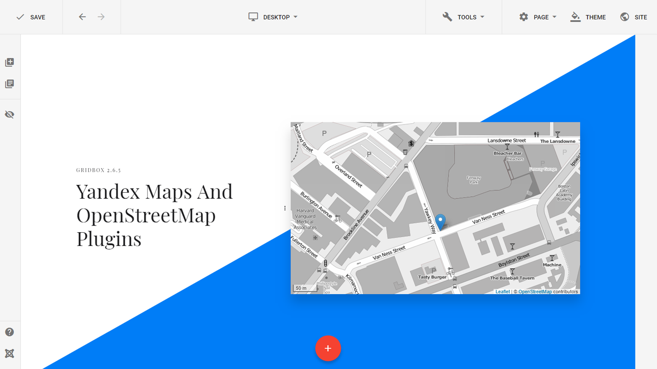
Yandex is a Russian machine-learning navigational tech company, which seems to have created a perfect alternative to Google Maps, with its 10 years of experience in navigation and transportation services. Yandex.Maps offers it all to rival Google Maps, including voice prompts, alerts for upcoming speed limits and traffic cameras, and traffic congestion info updated in real-time.
The new software even has the option to download directions into an offline mode, for when you run out of data or venture out on an off-road adventure in the bush somewhere.
Yandex.Maps is currently only available in Russia, and requires a paid “Yandex Plus” subscription if drivers want to make use of the novel dashboard-navigation experience.
The company does offer Russians a three-month free trial to test it out before buying, though. And for all we know, the $2.30 equivalent of the 169 Russian rubles that are charged as a monthly usage fee may just be worth it if it outperforms Google Maps in precise road mapping and route calculation.
Google Maps isn’t always updated to reflect the opening up or blocking off of smaller streets, or acknowledge the existence of some legitimate off-road routes, for example, especially outside the USA—so it’s possible Yandex.Maps could be a truly worthy alternative.
Even if it’s only a Russian breakthrough at the moment, it’s also a breakthrough in the sense that more developers are showing an interest in taking advantage of the free Android Auto app market and looking for ways to compete with Google in the car-optimized navigational software sphere.

New Google Maps widgets now available for iPhone

New helpful features are added to Google Maps
Google continues to work on Google Maps as the app matures from one that gets you safely and quickly from point “A” to point “B” to one that not only gets you to point “B” but also shows you where to go, stay, eat and more once you do arrive at point “B.” Today, Google announced some new features for Maps that are designed to help users deal with some of the pains of travel whether it is the daily commute to the office, a vacation, or just a jaunt to the local supermarket to stock up.
The new features for Google Maps include one that will come in handy for commuters and others. If you happen to rely on public transit for the majority of your trips, you can now get the lay of the land and discover how crowded your subway car, bus, or train will be. This is important if you hate getting squeezed inside a subway car with sweaty, irritable commuters.
If Google Maps informs you that you should expect a cramped ride, you can always wait for the next subway car, bus or train so that you can enjoy some space and perhaps more importantly, some peace and quiet on your journey. The information is computed using machine learning AI and will soon be expanded to cover more than 10,000 transit agencies in 100 countries around the world.
In New York and Sydney, Google is testing the release of this information for the individual car levels on trains. This will allow Google Maps users to choose where to stand on the platform in order to find the least crowded part of the train.
With new variants of COVID like Delta and the deadly Lambda versions keeping the pandemic alive, Google knows that it is still important for people to know the latest news about COVID-19. The COVID layer on Google Maps will provide information about what is happening in your area about COVID including restrictions that you need to know about and local resources that you might find helpful.
Google suggests that before you leave for your destination, go to Google Maps, search for your destination and scroll down to the Business Profile to see how busy the place is right now. This way you can adjust your plans if your destination is mobbed. Some businesses allow you to schedule an appointment through Google Maps. All you need to do is search for the business, check availability, and reserve your time. You can make changes and manage your appointments via the app’s Saved tab.
Google Maps will soon allow you to look back in order to plan ahead. All Android users can use the Trips tab to revisit past trips. Google notes that you can export this information and share your past travels with others.
The Business Profile will also show a location’s operating hours, current COVID-19 safety precautions, trending dishes, and reviews. Speaking of dishes, tapping on prompts inside Google Maps will allow you to share information for any restaurant in the U.S. including the eatery’s average price range or whether you ate in or took the meal home to consume.
Lastly, Google Maps will allow users to pay for things like street parking or public transit directly from the app. For the former, type in the meter number and then hit pay and refill to make the contactless payment. When you arrive at any public transit, your phone will show an option to make a payment which you can tap to initiate.