Retail News CRM

Tag: maps

  • Google Maps is getting new features

    Google Maps is getting new features

    Over the past couple of years, software and technology have become considerably more aware of the user. This extends from using biometrics to unlock your phone, to having your vitals regularly checked by a smartwatch on your wrist, to getting pestered by a digital well-being assistant. Health monitoring as a whole has proven to be potentially life-saving many times on an individual scale. But what about large groups of people, possibly the populations of entire cities, who may be at risk?

    Google Maps already provides relevant information during times of crisis with SOS alerts. These include real-time updates on the situation, a map of the affected area, emergency contact information, and translations for common phrases in the local language. With the latest update to Maps, SOS alerts are expanding with more detailed visuals and a new crisis navigation system will try its best to get you—and potentially hundreds, if not thousands of others—out of harm’s way.

    For example, in the case of a hurricane, you’ll automatically get a crisis notification card on Google Maps in the days leading to the expected disaster. The map will also display the predicted trajectory of the storm, alongside times when the hurricane is expected to hit certain areas in your vicinity. If you happen to be driving through an affected region on the day of the storm, you’ll get a suggestion for a safer route alternative. Such suggestions will be offered for all types of disasters while driving, starting later this summer.

    In the case of an earthquake, the crisis notification card will display a shakemap, which is a visualization of the earthquake’s epicenter, magnitude, and how surrounding areas were affected. Flood forecasts will notify you of possible floods, as well as where they are likely to occur, and where the waters are expected to flow. Google says this is especially important in regions like India, where over 20 percent of global flood-related fatalities occur.

    The revamped SOS alerts system will start rolling out to Android, iOS, and the web version of Google Maps in the coming weeks. Flood visualizations will first launch in Patna, India, and will spread to neighboring regions, and eventually globally, though curiously they won’t be coming to iOS, at least initially.

  • Google Maps speed camera alerts and speed limit indicators rolling out

    Google Maps speed camera alerts and speed limit indicators rolling out

    One of the important features that differentiate Waze from other navigation apps like Google Maps is the possibility to see in-depth traffic information and get alerts about speed cameras and speed limits indications.

    Surprisingly, the feature didn’t make it to Google Maps yet, even after the search giant acquired Waze. Well, the anomaly is about to be completely dissipated as Google Maps users in a bunch of countries report they are now getting speed camera alerts and can now see speed limit indicators.

    Speed camera alerts should now be available for many users in the following countries: Australia, Brazil, Bulgaria, Canada, Czech Republic, Finland, Greece, Hungary, India, Indonesia, Israel, Italy, Mexico, the Netherlands, Portugal, Romania, Russia, Saudi Arabia, Slovakia, Slovenia, South Africa, Spain, Sweden, the UK, and the US.

    Furthermore, another new Google Maps feature, the option to see speed limits while driving, is now live in Denmark, Poland, the UK, and US. However, we expect these features to roll out to all Google Maps users worldwide, it’s just that this appears to be a released gradually, so we’ll just have to wait until Google enables it for more people.

  • Google Maps is Adding Yelp Features

    Google Maps is Adding Yelp Features

    Over the past couple of years, Google Maps has transformed from a simple navigation app to one of the most powerful information databases for travelers and commuters around the world. Booking a hotel room, reserving a table at a restaurant, or simply checking working hours are all things made increasingly easy through Google Maps with its community-driven spirit. Soon, a new feature will be added to that ever-expanding list that will challenge Yelp.

    Crowd-sourced reviews are nothing new on Maps. As is, the app sends notifications to users, prompting them to rate places they’ve visited, and encourages them to share pictures. However, Google is looking to implement a new, dedicated food review system into the app, thus allowing users to rate individual dishes when visiting restaurants. The system will take a few factors into consideration, such as pricing, quantity, and quality, and will ask users whether they’d recommend the dish or not. And, of course, everyone will be encouraged to snap some photos of the impressive (or otherwise) dishes that they got served.

    Select venues on Google Maps already offer a “Menu” tab that can give you a rough idea of what to expect and how much it will cost, but the update aims to expand this functionality and put crowd-sourced reviews at the forefront. Ultimately, the goal is to have detailed menus for each venue, divided into sub-tabs based on popularity and the type of dish.

    Currently, dishes in the “Menu” tab are presented in a simple list form, but in the future, they will appear in card form alongside user-made photos. You will be able to tap on them to see others’ reviews, leave your own, suggest edits, and so on. Google has already started an initial testing phase of the feature. A wider roll-out can probably be expected in the coming months.

    With the implementation of food reviews in Maps, Google has Yelp in its sights. Both apps have long offered similar features, including restaurant reservations and user reviews, but Yelp had the edge when it came to detailed, crowd-sourced food reviews. With Maps adding this feature to its roster, it has the potential of becoming a viable Yelp competitor on all fronts.

  • Google Maps adds real-time info for EV charging stations

    Google Maps adds real-time info for EV charging stations

    There are so many reasons to love Google Maps right now, some of which have very little to do with the core functionality of the world’s most popular web mapping service or the numerous handy navigation features borrowed from Waze over the past few months.

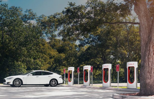
    One extremely convenient thing you’ve been able to do since last fall with Google Maps is easily find electric vehicle (EV) charging stations around the world, and now the feature is further improved to save you some hassle and avoid wasting your time. In addition to just showing you nearby charging stations and helping you reach them by taking the fastest route, the wildly successful app can also provide real-time information on the availability of actual charging ports.

    No more waiting in line for “anywhere between minutes to hours”… unless, of course, you don’t mind taking your chance or don’t have much of a choice of EV charging stations in your area. But if you do, Google Maps will display exactly how many ports are actually available at any given time in stations from Chargemaster, EVgo, and SemaConnect networks. Keep in mind that the expanded functionality is only supported in the US and UK at the moment, with Chargepoint slated to join the aforementioned list of partners “soon.”

    As you can imagine, it’s incredibly easy to locate the closest electric vehicle charging station. You simply enter “ev charging” or “ev charging stations” in the app’s search box, which will bring up a list of relevant places from where you can access the number of available ports, their types and charging speeds, as well as other driver-provided info about a specific station, like photos, ratings, reviews, and questions.

    Don’t forget to update Google Maps on your Android handset or iPhone to the latest version published to Google’s Play Store or Apple’s App Store. The new feature should already be live for users of both mobile operating systems.

  • Google Maps is using Waze Features

    Google Maps is using Waze Features

    Google paid almost a billion dollars for the popular Israel-based Waze navigation app back in 2013, but curiously enough, the search giant took an awfully long time to integrate some of the basic features of its daughter service into the main Maps platform.

    For instance, Google Maps users barely started seeing options to report crashes and speed traps added to their navigation service of choice a few months ago, with a wider rollout of these two features subsequently noticed and a handy third option seemingly enabled as we speak. As usual, we’re looking at a staggered release, with a handful of screenshots shared by Android Police proving some people can add reports of crashes, speed traps, andslowdowns, while others are still waiting to get the first two parts of the incident reporting functionality.
    With the traffic slowdown feature, also known as congestion in certain regions, Google Maps users should be able to contribute to a smoother navigation experience, with more realistic ETAs and helpful re-routing suggestions during peak hours. Along with the crash and speed trap reporting functionality, this will make Google Maps bear an even stronger resemblance to Waze, possibly escalating speculation that something might be going on soon.
    Of course, unlike services like Google Plus, Inbox, or Allo, Waze is actually beloved and actively used by millions of people around the world. Specifically, more than 90 million drivers, according to the company’s latest official count, spending an average of 438 minutes in the app each and every month. That’s not something you can afford to throw away very easily, so we’re guessing Google Maps and Waze will remain separate but increasingly similar for many years to come.
  • TomTom IQ Maps Makes Global Premiere In India With MG Hector

    TomTom IQ Maps Makes Global Premiere In India With MG Hector

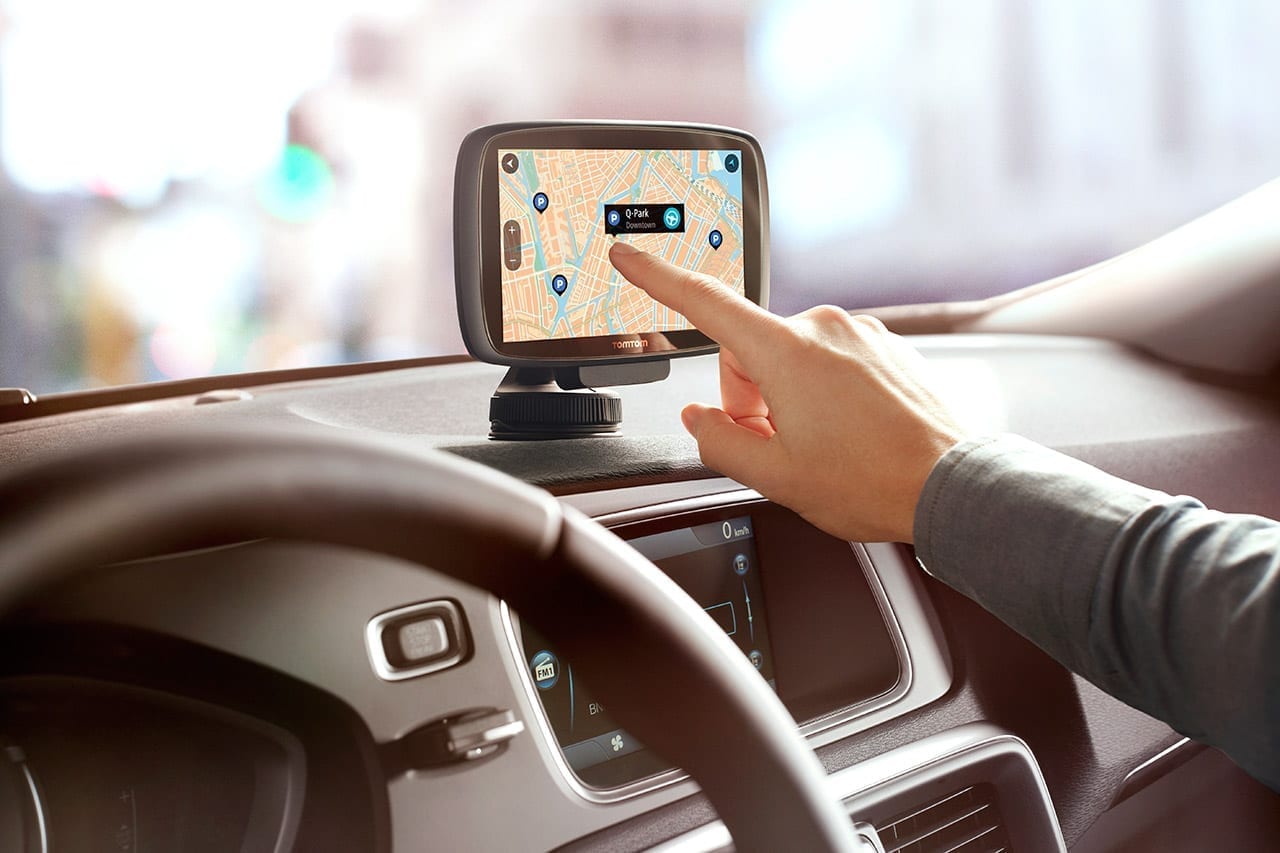
    The MG Hector is still a few weeks away from hitting the market but the SAIC-owned brand has taken the wraps off the car’s connectivity and IT services. In a bid to offer a first-in-segment connected car, the MGHector sees the company bring several big names in IT and services together to create its i-smart platform. Besides Microsoft, Cisco, Nuance et al, there is also the world’s leading name in navigation systems – TomTom. And a unique offering from the Netherlands based player is an immediate area-only self-updating new navigation system called IQ Maps. Speaking carandbike Tsjerk-Friso Roelfzema, VP Automotive – Europe & Asia, TomTom said, “You don’t have to do anything, plug in a new CD or DVD, a USB, or go to a dealer. It’s automatically updated in the background, and not just only automatically updated, but only what is relevant to the driver. So we are here in Delhi today, you don’t want to have the updates of your map let’s say in Pune, it’s not relevant. So we update what is relevant to you.”

    TomTom’s self-updating new navigation system called IQ Maps will be introduced with the MG Hector

    The IQ Maps idea is simple. The car will have embedded maps for the whole country as is. But these maps get outdated quickly; especially in a country like India here our road systems are constantly undergoing detours or changes due to fresh construction or improvements in infrastructure. IQ Maps helps the car to provide you with updated and current maps, without worrying about those kinds of changes. And yes the system is in-dash – and will work through the big 10.4″ screen on MG’s i-smart unit.

    It also gives you real-time traffic updates, and will reroute your guidance if there is a traffic jam for instance. It also takes into account any last minute road closures or other changes like say, construction activity. The map is updated accordingly, and is fed with a combination of live and historical data inputs to achieve its levels of accuracy. This has been made possible not just because of the innovation at TomTom’s research centres in Europe and also in Pune, India.

    Of course the enabler here is also the vehicle itself, which would have to provide connectivity, since this is an in-car navigation system and not an external device or phone app. And that connectivity on the MG Hector will come courtesy the embedded eSim card the car will have from the start. This in turn will provide data services to not just update maps and conduct live searches for destinations or points of interest, but also stream music, browse the net or access your email. The eSim will also be the way to contact MG’s call centre where a concierge service can hep you find destinations, or more importantly provide first response in the case of an emergency. And the good news is MG has said the data plan for the buyer if the car will be free.

    TomTom plans to develop the product further both in terms of offering even more layers of sophistication, and also see if it can be offered in standalone navigation devices or as a phone app. But there is another potential area where it could be even more relevant. Roelfzema says, “It is very important today in normal navigation, but especially when you talk about autonomous driving, you really want to know if the road has changed if your car is driving itself. And that’s really important. We need to see when the rest is following, but it is a very exciting moment also for us.”

  • Google Maps update brings Nokia’s classic Snake Game

    Google Maps update brings Nokia’s classic Snake Game

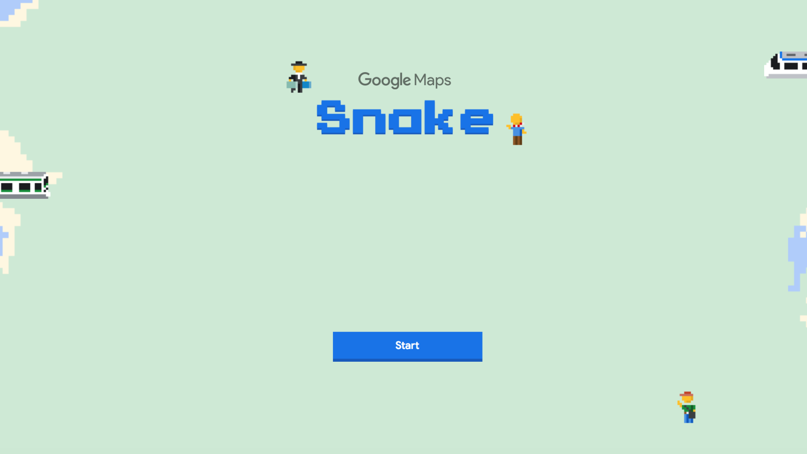
    The classic Snake game that made its debut on Nokia phones back in 2007 and achieved popularity not long after, is now available to all Google Map users. Well, let’s say that a very improved version of that game can now be played by Android and iOS users directly in Google Maps.

    Apparently, Google continues the tradition of celebrating April Fools with a long-lasting gag that will be available to those using some of its services on mobile and desktop. This year Google has decided to make Maps the main platform of its gag.

    All Android and iOS users will be able to play Snake on their phones and achieve high scores by picking up as many passengers and visiting as many iconic locations as possible. You’ll be able to play in different locations across the world, such as Cairo, London, San Francisco, Sao Paolo, Sydney, and Tokyo, or simply choose to play in the World.

    In order to start playing Snake, you’ll have to open the Google Maps app, tap on the menu icon on the top left corner, then select “Play Snake” to start playing directly in the app.

    Depending on what city you chose to play in, you’ll have to gather passengers with your ever-growing train and visit important locations around the world, including Big Ben, the Great Sphinx of Giza, and the Eiffel Tower.

    The Snake game is now rolling out worldwide on Android and iOS and will be available from within the Google Maps app for about a week.

  • Google Maps is rolling out a new feature allowing public event creation

    Google Maps is rolling out a new feature allowing public event creation

    Google Maps is a staple not only for Android users but for many iPhone and PC users as well. Its rich functionality is just as helpful when you’re on the go as it is when you’re relaxing at home and want to explore another city, whether that’ll be through satellite pictures or Google Street View.  It’s no secret that the majority of the information that can be found on Google Maps has been added by the users themselves. Business owners add the locations of their offices, stores, restaurants and everything else you can think of. On the other end, customers get to add their comments, ratings and pictures to each place they’ve visited. Recently Google also introduced some of the features of Waze to Google Maps, allowing users to mark speed traps and car accidents.

    Now, even more power to add content is coming to the people, as Google has added the option for users to add public events. The new feature was noticed by SlashGear and the way it works is described on the Google Maps support page. You can add an event either from your Contribute tab, where you’ll see a new “Add a public event” button (you might need to scroll down a bit to see it) or from the Events tab. After that, you get to fill out the standard set of information: type of the event, location, time and description.

    Once you post an event, it will appear at the selected location for everyone to see, so be careful what you post. Google has a set of steps on its website for deleting public events you’ve created, but at least for us, the “Delete this event” button mentioned on the support page was nonexistent.

    It seems there’s some more work to be done on this feature, which is likely why it’s not actually available to everyone right now. We haven’t been able to pinpoint exactly who has access to it, but it appears to be just some Android users for now. If you have the Events tab on the Your contributions page, then you’re part of the early adopters.

    A new wave of unique events is coming

    Either way, this feature is a good way for people to promote more casual events that aren’t tied to a specific commercial location. For example, you might need people for a game of basketball or fellow hobby enthusiasts to join your RC car race. Or maybe you’re a street performer that has something new to show and you want to organize a premiere.

    Utility companies or city administrations can also make use of these public events to let people know when certain streets will be closed, Google has added a “Parade” category for a reason. Another helpful category is Volunteering & activism. You’re planning to clean up an area as part of the now trending #trashtag challenge? Set up a public event and gather helpers in no time.

    We see, however, a potential for this feature to be abused and people creating fake events to draw a crowd somewhere. There is a “send feedback” button for the created event that lets you report if there’s anything wrong with it. Perhaps Google will use such feedback to limit the rights of people that create fake events.

    Hopefully, there won’t be much of that going on and people will use the feature for its intended purposes. It will probably take a while before it becomes popular and we get to see more interesting events around us. Once the option to add one is available to everyone, however, it will be a matter of time before you start noticing them around.

  • The Google app hits an impressive milestone in the Play Store

    The Google app hits an impressive milestone in the Play Store

    Remember when the Google Play Store was called the Android Market? Google changed the name on March 6th, 2012. Twenty-six months later, Gmail became the first Android app to reach 1 billion installs. Since then, two other apps in the Play Store have been installed over 5 billion times-that is, until today. Google Maps and YouTube have been joined in the exclusive club by the Google app.

    Video streaming site YouTube was the first Android app to hit 5 billion downloads, and was followed this past weekend by navigation app Google Maps. Now, the Google app itself  has joined the club. Technically, there are four members if you include Google Play Services, but this is a systems app that allows an Android phone to update Google developed apps and apps from the Google Play Store.

    The three apps, YouTube, Google Maps and Google, are not only must-haves for every Android user, they are also pre-installed on every Android phone that comes with Google Play Services out of the box. When an app is pre-loaded onto an Android device, that is included in the total number of installations.

    Google has worked on expanding the features offered by each of the three apps in the 5 billion installs club. Besides offering streaming videos from amateurs, the site now includes trailers from movies and clips taken from television shows. In addition, YouTube now offers its own original programming for paid subscribers. Google Maps has added several new navigation based items, including the ability to report a crash or speed trap, a speed limit reminder, and more. It also has moved into the lifestyle category by showing places of interest to visit in your home town and locations you travel to.

    The Google app, which helps users search for websites, also reports news, sports and weather of interest to the user. A summary of the user’s schedule for the day can be seen thanks to Google Calendar integration, and a list of stock prices can be monitored. All three apps do have iOS counterparts in the Apple App Store.

  • TomTom wins deal to provide Volvo Cars with maps, data

    TomTom wins deal to provide Volvo Cars with maps, data

    TomTom, the Dutch navigation company, said on Wednesday it had won a contract to provide Volvo Cars with real-time maps and traffic data for its vehicles.

    Terms were not disclosed, but the contract is a major win for TomTom, which competes with Google Maps and HERE, the former Nokia unit now owned by Audi, BMW and Daimler.

    TomTom, once known mostly for dashboard-mounted GPS systems, has won a string of contracts for its mapping technology, which it believes will play an important role as car driving becomes increasingly automated.

    Other TomTom customers include Volkswagen, Uber and Apple.

    TomTom’s shares are down more than 30 percent so far this year, declining sharply during the January market sell-off and again in February after issuing a forecast for 5 percent sales growth in 2016 that fell short of market expectations.