Retail News CRM

Tag: maps

  • Google Maps is giving out potentially fatal directions to mountain climbers

    Google Maps is giving out potentially fatal directions to mountain climbers

    When Apple launched its own mapping and navigation app in iOS 6, the goal was to replace Google Maps on the iPhone. But Apple Maps was such a fiasco that just weeks after the launch, CEO Tim Cook apologized for Apple Maps’ shortcomings and suggested that iOS users turn to alternatives like Google Maps, Waze, and other navigation apps until the issues were fixed.

    One particular mistake put Apple Maps users in real peril and led Inspector Simon Clemmence of the Victoria Police in Australia to call the app life-threatening. It turned out that the directions that the app provided to at least six people driving their vehicles to Mildura took them through the Outback with temperatures as high as 115 degrees. The area is lousy with poisonous snakes and cell reception is spotty.

    The problem was that Apple Maps had Mildura 43 miles away from its actual location. Australian cops put out a warning telling iPhone users that drivers who used the app to get to Mildura ended up driving for over 24 hours without food, water, or cell service. One person had to walk over 24 hours before finding cellular connectivity for his handset. Apple Maps has been greatly improved since and now it is Google Maps’ turn to disseminate potentially deadly directions.

    At the end of last week, the John Muir Trust and Mountaineering Scotland, the organizations that watch over mountain climbing, hill walking, snow sports, and similar activities in Scotland, released a warning. The organization expressed concern that climbers and hikers were using navigation apps to get directions to Scotland’s highest mountain named Ben Nevis.

    It seems that Google Maps is giving directions to hikers that could be lethal. At least that is the opinion of Heather Morning, Mountaineering Scotland’s mountain safety adviser. Morning says that “For those new to hill walking, it would seem perfectly logical to check out Google Maps for information on how to get to your chosen mountain…even the most experienced mountaineer would have difficulty following this route (from Google Maps).”

    Morning adds that “the line goes through very steep, rocky, and pathless terrain where even in good visibility it would be challenging to find a safe line. Add in low cloud and rain and the suggested Google line is potentially fatal.” Both organizations wish to speak to Google about removing any life-threatening routes. However, Google has reportedly yet to respond to appeals from John Muir.

    A Google spokesperson did comment about the possibly life-threatening directions and said, “We built Google Maps with safety and reliability in mind, and are working quickly to investigate the routing issue on Ben Nevis and surrounding areas.”

    Google said that it examining the issue and said, “To help both novice and experienced hikers more easily find trails that suit their level of expertise, we’re now updating our driving routes to take people directly to the visitor center, where they’ll be able to speak with staff about the best trail to take.” But the directions to Ben Nevis are not the only directions from Google Maps that could end up killing someone who follows the app’s directions.

    Mountaineering Scotland’s Morning states “Modern navigation technology brings some amazing advantages for hill walkers, but this example is clearly not one of them. Walkers and climbers with even a little experience will know to read information from a map, whether digital or paper, and if they are looking for downloadable routes know to use reputable sources and check several sources to ensure the information they are accessing is the right route for their level of experience and ability.”

    She goes on to say that “…especially on Ben Nevis, many people are not aware of where to get reliable information and may quite naturally assume that Google Maps, which got them from their home to the foot of the mountain, can carry on and do the job right to the top. This is not the case.”

    A couple of paragraphs ago we hinted that there is another possible fatal set of directions offered by Google Maps. According to Mountaineering Scotland,  a route shared by Google Maps to Scotland’s An Teallach mountain “would take people over a cliff.”
  • Google Maps’ Insights feature is rolling out in more countries

    Google Maps’ Insights feature is rolling out in more countries

    Google continues to work hard on improving Google Maps. The app does so much more than just help take you quickly and safely from point “A” to point “B” as it gives you the names of places to visit, where you should go to eat, events that you should attend while in town, and more. And now a newly redesigned feature named Google Maps’ Insights provides users with data about their travels that they might find helpful.

    Insights can show you the places that you’ve been traveling to and whether you got there by walking, biking, or by driving. You’ll see your travel history along with interesting information that reveals the busiest day of each month, the name of the attractions you’ve been visiting, the hotels where you’ve been staying, and the stores where you have been spending money.

    This might sound typically Google with all of your information being gobbled up, even if it is supposed to be for your benefit. But you can keep the information of your travels to yourself by using Google Maps while in incognito mode. You can also keep your privacy while using Google Maps by not logging in before you start to use the app.

    Keep in mind that if you do decide to use incognito mode on Google Maps. you will be unable to save your search or browsing history or send notifications. You also won’t be able to update Location History or shared location or personalize Google Maps.

    Insights is part of the Google Maps Timeline feature which can be found by tapping on your profile icon on the upper right corner of the Google Maps screen. The redesigned Insights is now rolling out to more regions around the world and Germany’s SmartDroid posted an image of the feature appearing in Germany containing all the statistics and data that Insights provide. The feature is also now rolling out in the U.K.

  • Apple Maps doesn’t collect data that can identify you on the iPhone like Google Maps does

    Apple Maps doesn’t collect data that can identify you on the iPhone like Google Maps does

    Unlike Google Maps, which is available on most of Apple’s devices, Apple Maps is only available to those using iOS, iPadOS, watchOS and macOS devices. In other words, Apple gets paid by device sales to help cover the costs of developing Apple Maps.

    Google, on the other hand, gets paid for Google Maps the same way it gets paid for anything it does-by selling advertising. If you look at the Privacy Labels on the App Store versions of Apple Maps and Google Maps, you can see that Apple Maps collects data from users, like Health & Fitness, Search History, Diagnostics, Location and User Data. But none of the data collected by Apple Maps is linked to a user’s identity.

    Google Maps’ Privacy Label for its iOS app shows that the app collects financial and contact information, User Content, Browsing History, Usage Data, Other data, Location, Contacts, Search History, Identifiers, and Diagnostics. This data can be collected by Google and linked to your identity. You could block this with the use of incognito mode which will prevent Google from collecting your data, but also limits some of the app’s functionality.

    To enable incognito mode on the Google Maps app, tap the profile icon in the upper right of the screen and tap  “Turn on incognito mode.” With this enabled, browser or search history is not saved, Location History is not updated, and Maps cannot be personalized.

    “Google Maps is designed to protect your information. We provide controls to easily manage your settings and use industry-leading technologies like differential privacy to keep your data safe. We continue to make Google Maps the best and most accurate way to navigate and explore the world—providing rich local business information, best in class search and navigation, and helpful features like the COVID layer and live business information.”

    Apple Maps has come a long way since its launch in 2012 when countries and streets were mislabeled and some users in Australia looking for directions to Mildura, Victoria was sent on a 24-hour trek across the outback to an area filled with poisonous snakes, no food, water or cell service. But Apple Maps is much improved and that improvement will continue with iOS 15.

    If you’re an iPhone user with a long memory, the time has come to give Apple Maps another shot. One of the features that we’ve found useful is the one that alerts us when a red light camera is in our path ready to look for drivers who commit a moving violation. And another feature will tell us whether to turn at the next light or to continue driving forward until we reach the light after the next one.

    And if you wear an Apple Watch, the integration between Apple Watch and the timepiece is outstanding. When you need to make a turn, you will feel haptic feedback on your Apple Watch that feels just like an automobile’s turn indicator against your wrist. This prevents you from missing a turn.

    Talking about the next build of iOS, Apple says that it is “committed to building the world’s best map and iOS 15 takes Maps even further with brand new ways to navigate and explore. Users will experience significantly enhanced details in cities for neighborhoods, commercial districts, elevation, and buildings, new road colors and labels, custom-designed landmarks, and a new night-time mode with a moonlit glow.”

    Google Maps has always been the first choice for mobile device users looking to navigate from point “A” to point “B,” but it appears as though Apple is ready to provide a strong challenge to Google.

  • New Google Maps feature directs drivers away from accident-prone routes

    New Google Maps feature directs drivers away from accident-prone routes

    Earlier this year we told you that instead of giving you the fastest route between two points by default, Google Maps will suggest a route that is more environmentally friendly and uses less energy. Now, looking to prevent accidents, the Google Maps app will route users away from roads where drivers are known for braking hard which can lead to accidents. Google will then give other drivers an alternative route to prevent accidents from happening.

    If a driver on the road slams on his brakes, a car behind him might not be able to stop in time causing a chain reaction of crashes. Keeping users away from those roads were slamming on the brakes is typical, Google hopes to see fewer accidents, fewer injuries, and safer driving. According to Auto-Evolution, over 100 million hard-braking events can be eliminated a year if Google Maps directs drivers to take safer routes.

    Google says, “For example, if there’s a sudden increase in hard-braking events along a route during a certain time of day when people are likely to be driving toward the glare of the sun, our system could detect those events and offer alternate routes.” The new feature will be available on both the Android and iOS versions of Google Maps.

    To determine which roads are dangerous because of drivers who are braking hard, Google turns to sensors that are placed inside drivers’ mobile devices. Accelerometers and gyroscopes can spot areas of the road where there is sudden deceleration pointing to hard braking. But even Google has to admit that just relying on sensors can lead to a false alarm.

    Slamming a phone into a cup holder can create a false alarm and Google Maps might read that sudden stop as a car whose driver just slammed on the brakes. To improve the accuracy of the feature, Google turns to AI and analyzes Google Maps to see whether the driver slammed on the brakes along the route that was taken. Google can also analyze the actions taken by other vehicles taking the same road at the same time in order to determine the reason why a driver slammed on the brakes.

  • After update, Google Maps will no longer give you the fastest route by default

    After update, Google Maps will no longer give you the fastest route by default

    Google is also working on improving how public transportation in being handled on the app. Along with the previous information that Google Maps would display for buses, trains and the subway, an update done on the QT in some regions has resulted in the dissemination of more detailed route information. The bottom line is that those taking public transportation will be able to see step-by-step information along with timing estimates to help give Maps users a more accurate estimated time of arrival (ETA).

    Recently, public transportation updates for Google Maps was pushed out for both Lyon and Lille, France. Google is working with the public transportation agencies in different regions to provide the aforementioned enhanced public transportation data. Many large cities throughout the world already have worked with Google on this feature which allows those without a car to benefit from Google Maps.<

  • Google brings back a nifty feature to Maps users on Android

    Google brings back a nifty feature to Maps users on Android

    Google adds new features to its mobile apps all the time, but sometimes, they remove the ones they don’t think are up to the challenge. We never know what’s behind these decisions, but we can definitely say that some features don’t deserve to be removed.

    That didn’t seem to interest Google’s Maps team when they decided to remove a very useful feature from the Android app, the compass widget. Last month, developers revealed many of the improvements that the Maps app will receive in the coming weeks but left one out from the initial announcement.

    Long story short, Google announced today that after removing the compass from Maps for Android in early 2019 “in an effort to clean up the Navigation screen,” it decided to bring it back after receiving overwhelming feedback in its favor.

    The compass will show you which direction is north via a red arrow. Just like it was implemented two years ago, the widget will be positioned on the right side of the screen. The “new” compass widget is now rolling out to all Google Maps for Android users globally, so as long as you have version 10.62 (or higher) installed, you should be able to use it.

  • Google Maps driving directions are going green

    Google Maps driving directions are going green

    Google has been hard at work keeping its Maps app top-notch these days, as it continues to compete in the neck-to-neck battle with Apple Maps. It’s been adding all sorts of features over the years, constantly improving your commuting experience—especially if you exploring a new city. Among many other things, it can now help you find great places to eat, sleep, and hang out, and even plan group get-togethers at a favorite joint.

    CNET has revealed that Google is rolling out a brand new feature to its driving directions function, this time aimed to help us live a little greener.

    Google Maps has announced it will be adding carbon emission minimization in its calculations for optimal driving directions. If there are two similar routes a driver could take, Google will now be able to take into account road inclines, traffic jams, and other factors in order to choose the least wasteful option. If the greener choice would significantly prolong the trip length, however, Google will let you know so that you can make the choice for yourself.

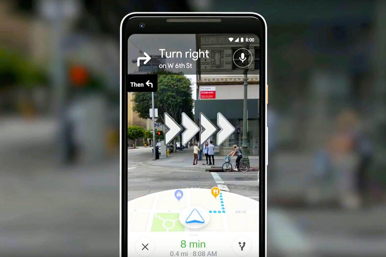
    Another upgrade Google Maps will be giving us is an improvement to its “Live View” alternate reality feature. Introduced in 2019, Live View superimposes virtual arrows onto the real world through your phone screen while you are walking, pointing you in the right direction. As of the new update, Google Live View will be available indoors in Westfield shopping centers across the U.S, including San Francisco, Chicago, and Los Angeles. The company has promised to bring Live View to Zurich and Tokyo airports eventually as well.

    Alongside these updates, Google is also trying out grocery pick-up options in a partnership with Fred Meyer (a division of the Kroger grocer) to encourage social distancing and safety amidst the COVID pandemic. This feature is currently being tested in Portland, Oregon, and Google will be sure to let us know will let us know if it goes nationwide.

  • Google Maps adds another useful feature from Waze

    Google Maps adds another useful feature from Waze

    Back in June 2013, Google bought Waze for a reported $1.1-1.3 billion. Since then, Google has handpicked some of Waze’s best features and added them to Google Maps. Features such as speed limit warnings, incident reports, and a speedometer have become part of Google Maps over the years. Another feature from Waze is coming to Google’s mapping and navigation app.

    Rolling out gradually to Google Maps users is a notification warning them that they are approaching a railroad crossing. The notification appears at the bottom of the screen and says “Expect Delays” because of the crossing. The map shows the location of the railroad crossing by denoting it with a round yellow icon with railroad tracks. It isn’t clear whether Android, iOS, or users of both platforms will get the railroad crossing notification first. It should be seen in the U.S. to start with the feature expanding to more countries over time.

    Some Google Maps users are starting to receive notifications when they approach a railroad crossing.

    It should be pointed out that Google has yet to announce this new feature. Often, when the company is adding multiple new features to Maps, Google will write a lengthy blog post that discusses the app’s new capabilities.

    Besides helping users navigate from point “A” to point “B” with turn-by-turn directions, Google Maps has matured to become a guide helping people visiting a strange city find places to eat, things to see, where they can stay the night, and much more.

  • Google Maps makes paying for parking a snap in over 400 U.S. cities

    Google Maps makes paying for parking a snap in over 400 U.S. cities

    Has any app become as useful as Google Maps has become over the years? Every time you turn around, Google has added a new feature. And now, Google Maps users will be able to pay for parking and train tickets directly from the app. If an event runs longer than expected, you can add time to your meter without having to run out of the venue in the cold, driving rain, or miss the game-winning play or the show-stopping number just to feed the meter. You can also avoid touching parking meters, some of which could be lousy with coronavirus.

    Here’s how it works. As you approach your destination (which you’re tracking on Google Maps), the app will show a button that reads “Pay for Parking.” Enter the meter number, the amount of time you want to park there, and tap on pay. Pay for parking starts today with the Google Map app on Android phones in over 400 cities including Boston, Cincinnati, Houston, Los Angeles, New York, Washington D.C, and more. The feature will be coming to iOS soon and is driven by the Passport and ParkMobile apps.

    If you’re looking for transit directions on Google Maps, you’ll see a button giving you the option to pay for public transportation using the credit or debit cards connected to a Google Pay account. Google is adding the ability to pay transit fares from Google Maps for 80 transit agencies around the world. As Google says, “Now you’ll be able to plan your trip, buy your fare, and start riding without needing to toggle between multiple apps. You can understand how to pay in advance and even get your fare ready to go before you arrive at the station – which is helpful when you’re not sure what payment options a transit agency supports.

    When you get transit directions, you’ll see the option to pay with your phone with the credit or debit cards already linked to your Google Pay account. And in places like the San Francisco Bay Area, you’ll also be able to buy a digital Clipper card directly from Google Maps. Once you’ve purchased your fare, all you need to do is tap your phone on the reader or show your digital ticket to breeze on board.” Google Maps’ expansion to 80 transit agencies for ticket payments will rollout on Android in a few weeks.

  • Cleaner UI is being tested for Google Maps

    Cleaner UI is being tested for Google Maps

    Google Maps does a lot more than get you safely from point “A” to point “B” on time. It also tells you where you can find restaurants that serve certain food in the city that you’re visiting, where you can find some entertainment nearby and more. The bottom line? Google Maps provides those on the go with very important information that they need to get through the day.

    Google is testing a new look for the Google Maps app that replaces the white bar now found on the top of the route option screen with the user’s starting location and his destination. Icons resembling the different modes of transportation such as driving, public transportation, walking, biking, and others are now gone from the destination box.

    These options are now found in a scrollable list moved to the bottom half of the display. Each mode of transportation shows how users how long it will take them to reach their destination using that mode. A “Depart at” button allows the user to set a specific time to start a journey, and an “Options” button will likely offer users routes to avoid highways, tolls, and more.

    The new UI makes it easier for Google Maps users to see the difference in transportation time for their route depending on the mode of transportation being used. The new route option interface is currently being tested so don’t waste too much time wondering why you don’t see it yet on your phone. Google, as we told you recently, is testing a split-screen interface for Maps’ Street View navigation.

    If for some reason you don’t have Google Maps on your phone, you can tap the appropriate link to install the app from the Apple App Store or the Google Play Store.

  • Google Maps Street View might soon allow users to upload their own photos of places and streets

    Google Maps Street View might soon allow users to upload their own photos of places and streets

    Google Maps is now one of the most popular navigation and exploration tools, and a new feature coming to its Google Street View might soon allow people to upload photos to make sure hardly reachable areas of streets or cities can be visible in Google Street View. The feature to upload images will be present in the standalone app Google Street View, which will allow you to use your smartphone to contribute to Google Maps.

    In the beginning, in order to be able to place you on a street in Google Maps, Google had cars that went about with big 360-degree cameras that took photos of the streets. This later helps anyone who needs more precise navigation or to get a feel of the streets in Google Maps and Google Street View to virtually place themselves in the middle of the street and look around.

    Now, to further this capability and make previous unavailable-for-visualization places accessible, Google’s Street View will have a feature that can use your smartphone to take photos of the place as you drive. Reddit user -J-G- spotted the feature in Google Street View Driving mode. Additionally, Google might need to use some image processing and software to merge the photos together for a 360-angle view.

    As expected, the app will blur faces and vehicle plates, protecting the privacy of everyone while at the same time providing more images and visualization to Google Street View in places unreachable for Google alone.

  • Google adds a COVID-19 layer to Google Maps

    Google adds a COVID-19 layer to Google Maps

    Google continues to work on improving Google Maps and on Wednesday a “COVID-19 layer” started rolling out. With this layer, users can see areas where the virus is spreading and it is coded by color based on the number of people with the coronavirus in each region. The layer produces these color codes based on the seven-day average for the number of new COVID-19 cases per 100,000 people and even reveals whether the number of cases is trending higher or lower.

    Google said that over a billion people rely on Google Maps to help them safely get from point “A” to point “B.” And that includes safely navigating around the virus by using the COVID-19 layer. As Google says, “This week, we’re introducing the COVID layer in Maps, a tool that shows critical information about COVID-19 cases in an area so you can make more informed decisions about where to go and what to do.”

    When you open Google Maps, tap on the layers button in the upper right corner of the screen and click on “COVID-19 info.” You will then see the seven-day average of new COVID cases per 100,000 people for the area of the map you’re looking at. The color-coding also reveals the density of new cases in the area. The COVID-19 layer starts rolling out on iOS and Android phones this week.

    The source of the data that you’ll see comes from legitimate places such as Johns Hopkins, the New York Times, and Wikipedia. Those places get their info from the World Health Organization, state and local health agencies, government organizations, and hospitals. And while consumers can get the same info through Google Search, they can also obtain it from Google Maps. As Google says, “While getting around is more complicated these days, our hope is that these Google Maps features will help you get where you need to be as safely and efficiently as possible.”

  • Google Maps returns to the Apple Watch

    Google Maps returns to the Apple Watch

    Back in 2017, Google Maps no longer worked with the Apple Watch. The reason why Google pulled it from the Apple Watch reportedly had something to do with the app’s limited capabilities on the watch compared to the iPhone app. At the time that Google made this announcement, it promised that Maps would return to the Apple Watch. And that apparently is what is happening. After a new update, Google Maps is once again available for Apple Watch wearers providing them with directions and the estimated time of arrival.

    Users cannot input a new destination directly on the watch and Google directs wearers to enter a location using the phone app and then moving to Apple Watch. Using Google Maps on Apple Watch will allow those walking, driving, taking public transportation, or riding a bicycle from point “A” to point “B” to receive step-by-step directions and show the Estimated Time of Arrival. The primary screen on the Apple Watch shows the user’s current trip with travel times to other destinations such as work and home. Icons show when a turn needs to be made and also identify the current mode of transportation being used. Haptics help users know when they need to make a turn and there is a complication on the Apple Watch that shows the Google Maps icon and opens the app.

    Live Google Maps are not available on the Apple Watch (although live Apple Maps are). Version 5.5.2 of Google Maps is available for the Apple Watch through the App Store.

  • Google Maps continues to stay a step ahead of the crowd

    Google Maps continues to stay a step ahead of the crowd

    Google uses historical traffic data with Google Maps to help it produce an estimated time of arrival (ETA). This allows a user to see what time he should arrive at his destination. The ETA can also be shared with friends or family so that the user won’t have to pick up his phone while driving to pass along the information. But we don’t have to tell you that there have been changes in traffic patterns over the last few months because of the pandemic which led many cities to shutdown. When cities starting closing earlier this year, worldwide traffic declined by as much as 50%.

    The lockdowns led to a situation where data from Google Maps could not be relied upon, forcing Google to revise traffic patterns.  To account for the effects of COVID-19 on Google Maps, the apps prioritize more recent traffic patterns from the last two to four weeks while deprioritizing patterns from any time before that.

    Last week, Google published a blog post that discusses how the company computes traffic and routing on the Maps app. Location data is aggregated and used as a tool to determine what the traffic is like on roads around the world. As Google points out, this information is great at determining current driving conditions but doesn’t explain what will happen to traffic “10, 20, or even 50 minutes into your journey.”

    To guess what will happen in the future, Google Maps analyses traffic patterns on specific roads. For example, one pattern shows that the 280 freeway in Northern California typically has vehicles traveling at 65mph between 6-7 am, but only at 15-20mph during the late afternoon. Google combines the data from historical traffic patterns with the data from live traffic conditions. Using machine learning on both sets of data, Google generates an estimate of an estimated time of arrival.

    Google says that on 97% of trips using the Maps app, its predictions have been accurate. Partnering with parent company Alphabet’s DeepMind AI research lab, Google can reduce the number of inaccurate ETA’s through the use of Graph Neural Networks. Available in places like Berlin, Jakarta, São Paulo, Sydney, Tokyo, and Washington D.C., the technology allows Maps to predict whether you will be caught in a slowdown that hasn’t even started yet.

    To help the app pick the route that you should take, different factors are looked at including the amount of traffic along the way; less traffic is preferred of course. Road quality is also important; is the road paved or is it a gravel-covered road that is hard to drive on. Other drivers can report things like the weather (snowstorm, torrential showers, etc.), accidents, construction, and police activity that can slow things down.

    Have you ever used Google Maps to get directions to a place that you’ve been to many times before, but noticed that the app is taking you a different way? That’s because Google will find a new route if the usual one includes delays. Google describes what happens: “Say you’re heading to a doctor’s appointment across town, driving down the road you typically take to get there.

    When you leave the house, traffic is flowing freely, with zero indication of any disruptions along the way. With Google Maps’ traffic predictions combined with live traffic conditions, we let you know that if you continue down your current route, there’s a good chance you’ll get stuck in unexpected gridlock traffic about 30 minutes into your ride—which would mean missing your appointment. As a result, Google Maps automatically reroutes you using its knowledge about nearby road conditions and incidents—helping you avoid the jam altogether and get to your appointment on time.”

  • Updates to Google Maps add more detail to countries and city streets

    Updates to Google Maps add more detail to countries and city streets

    Google has been continually improving the Google Maps app and today some new visual improvements for the app were announced. The changes add more detail to the imagery giving the user more information when taking a virtual drive through an area, or when planning a visit. One update to Google Maps brings a more natural look to an area being viewed on the app. As Google notes, “Exploring a place gives you a look at its natural features—so you can easily distinguish tan, arid beaches and deserts from blue lakes, rivers, oceans and ravines. You can know at a glance how lush and green a place is with vegetation, and even see if there are snow caps on the peaks of mountaintops.”

    This can be achieved through Google’s high-definition satellite imagery that covers 98% of the global population. Add to that a new color-mapping algorithmic technique and Google Maps becomes more vibrant showing better details and more realistic colors that make it easier to understand the environment of a specific area. The color mapping technique starts by using a computer to pick out natural features found in satellite images looking specifically for “arid, icy, forested, and mountainous regions.” These areas are analyzed and assigned different colors using the HSV color model. As an example, Google says that it would use dark green to signify an area with a densely covered forest. A lighter shade of green could be used to show an area of “patchy shrubs.”

    The update to Google Maps leaves the app with “one of the most comprehensive views of natural features on any major map app—with availability in all 220 countries and territories that Google Maps supports. That’s coverage for over 100M square kilometers of land, or 18 billion football fields!” Google states that the “This update is visible no matter what area you’re looking at—from the biggest metropolitan areas to small, rural towns.

    Besides helping users visualize the natural conditions of a country and region, Google Maps will soon be delivering more detailed street information that not only shows the correct scale of a road but will also include the correct shape of it. Correct placements of sidewalks, crosswalks, and pedestrian islands will appear, important information for those in a wheelchair or pushing a stroller. It also is helpful to people taking solo walks due to the pandemic. In the coming months, the detailed street maps will roll out in New York, London and San Francisco with more cities added over time.

    The more natural images will start rolling out this week and can be viewed by zooming out on the app. Google Maps Platform developers will soon be able to use the new look for their maps. You can install Google Maps on your iOS device from the App Store and download it on your Android device by snagging it from the Google Play Store.

    As Google continues to add more and more features to Maps, Apple is also buying working on its mapping app. In June 2018, Apple announced that it was building Apple Maps from scratch and would use its own mapping data instead of using third-party providers like TomTom. Specially designed Apple vehicles have driven 4 million miles to capture more detailed and refined views for users. While Apple tries to catch up with Google, the latter continues to be the unquestionable leader in navigation for mobile device users.