Tag: satellite

  • Inmarsat and Skylo collaborate on world’s first commercial narrowband IoT over satellite solution

    Inmarsat and Skylo collaborate on world’s first commercial narrowband IoT over satellite solution

    Inmarsat will provide Skylo, a satellite-based narrow-band (NB) IoT solution company the satellite capacity backbone to deliver its IoT solutions for connecting machines and sensors.

    The agreement pairs Inmarsat’s exceptionally reliable global satellite network with a complete, easy-to-use IoT solution that provides even the most remotely located application users with real-time, actionable insights; helping improve efficiencies, increase profits, improve sustainability, and save lives.

    The solution is available now in India through a partnership with in-country partner BSNL and expansion plans will be announced later this year.

    “The most effective IoT solutions require a truly resilient and flexible network that can scale as demand grows,” said Rajeev Suri, Inmarsat Chief Executive Officer.

    “Inmarsat’s industry-leading L-band network provides a unique capability for enabling the billions of connected IoT devices in India and across the world that are being deployed at an extraordinary speed.  We are delighted to work with Skylo to provide the IoT fabric that matches their ambition.”

    “Skylo makes simple, reliable IoT connectivity available to everyone at disruptively affordable rates,” commented Skylo CEO and co-founder Parth Trivedi.

    “Even more attractive than a sharp increase in adoption due to low barrier-to-entry is deploying critical new business capabilities as machine data becomes readily available and accessible. Our global IoT connectivity fabric makes way for thousands of life-changing applications — from managing vaccine efficacy during delivery to advancing precision farming, to provide early warnings in the event of natural disasters. We look forward to expanding globally and making our platform available to small and large enterprises, companies deploying new sensors, systems integrators, distributors, Governments and OEMs.”

  • SpaceX satellite Internet faces regulatory hurdles in Vietnam

    SpaceX satellite Internet faces regulatory hurdles in Vietnam

    U.S. aerospace company SpaceX can only launch its satellite Internet service Starlink in Vietnam if it ties up with a local partner, Vietnam’s Department of Telecommunications said.

    SpaceX, owned by South African-American billionaire Elon Musk, recently announced that Starlink, now in its beta testing phase, would be launched in Vietnam next year and customers could preorder it for $99.

    However, telecommunications and Internet companies are in the list of conditional businesses, which requires the foreign enterprises to partner with a Vietnamese enterprise that is licensed to provide telecom services or establish a joint venture.

    According to the Department of Telecommunications, foreign enterprises are not allowed to independently provide internet and telecommunication services in Vietnam.

    The Department of Telecommunications told VnExpress that the company has yet to apply to launch the service in Vietnam.

    The department said prospective subscribers should consider carefully before making the pre-order since “it is unsure if Starlink can provide satellite Internet services in Vietnam.”

    The pre-order is currently available in 15 countries, according to its website.

  • Satellite to track rising seas as climate warms

    Satellite to track rising seas as climate warms

    An Earth-observation satellite developed by European and U.S. space agencies will measure sea level rise, tracking changes threatening to disrupt tens of millions of lives within a generation.

    If all goes according to plan, the payload will be hoisted into a low-Earth 1,300-kilometer (800-mile) orbit by a Space X Falcon 9 rocket, with lift-off from Vandenberg Air Force Base in California at 17:17 GMT Saturday.

    Sentinel-6a will be the first of two identical satellites – the second to be launched in five years – that will provide measurements of unprecedented precision until at least 2030.

    Each Sentinel-6 probe carries a radar altimeter, which measures the time it takes for radar pulses to travel to Earth’s surface and back again.

    The satellites will circle the planet in the same orbit as earlier missions that supplied sea-surface height data over the last three decades, mapping 95 percent of Earth’s ice-free ocean every 10 days.

    Accelerating sea level rise is arguably the climate change impact that will affect the largest number of people over the next three decades.

    Nearly 800 million people live within five meters of sea level, and even an increase in sea level of a few centimeters can translate into vastly more damage from high tides and storm surges.
    An Earth-observation satellite developed by European and U.S. space agencies will measure sea level rise, tracking changes threatening to disrupt tens of millions of lives within a generation.

    If all goes according to plan, the payload will be hoisted into a low-Earth 1,300-kilometer (800-mile) orbit by a Space X Falcon 9 rocket, with lift-off from Vandenberg Air Force Base in California at 17:17 GMT Saturday.

    Sentinel-6a will be the first of two identical satellites – the second to be launched in five years – that will provide measurements of unprecedented precision until at least 2030.

    Each Sentinel-6 probe carries a radar altimeter, which measures the time it takes for radar pulses to travel to Earth’s surface and back again.

    The satellites will circle the planet in the same orbit as earlier missions that supplied sea-surface height data over the last three decades, mapping 95 percent of Earth’s ice-free ocean every 10 days.

    Accelerating sea level rise is arguably the climate change impact that will affect the largest number of people over the next three decades.

    Nearly 800 million people live within five meters of sea level, and even an increase in sea level of a few centimeters can translate into vastly more damage from high tides and storm surges.

    China, Bangladesh, India, Vietnam, Indonesia and Thailand are home to the greatest number of people who today live on land that could be threatened by permanent inundation by 2100.

    Already today, there are more than 100 million people living below high tide levels.

    “Extreme sea level events that are historically rare – once per century in the recent past – are projected to occur frequently, at least once per year, at many locations by 2050,” especially in the tropics, the UN climate science advisory panel, the IPCC, concluded in a major report last year.

    Satellites tracking the world’s oceans since 1993 show that global mean sea level has risen, on average, by over three millimeters (more than a tenth of an inch) annually.

    More recently, that rate has increased to 5 mm per year.

    “It is crucial that we are able to see these accelerations,” said Alain Ratier, outgoing Director-General of Europe’s meteorological satellite agency, EUMETSAT.

    The IPCC forecasts an increase in global sea level rise of up to 1.1 meters (43 inches) by the end of the century.

    The Copernicus Sentinel-6 mission is a collaboration of the European Commission, the European Space Agency (ESA), EUMETSAT, NASA and the U.S. National Oceanic and Atmospheric Administration (NOAA).

    The Sentinel satellites are each about the size and shape of a large minivan topped with slanted solar panels, and weigh nearly 1,200 kilos (2,600 pounds), including rocket fuel.

    They are designed to last for five-and-a-half years, but could provide data for far longer. China, Bangladesh, India, Vietnam, Indonesia and Thailand are home to the greatest number of people who today live on land that could be threatened by permanent inundation by 2100.

    Already today, there are more than 100 million people living below high tide levels.

    “Extreme sea level events that are historically rare – once per century in the recent past – are projected to occur frequently, at least once per year, at many locations by 2050,” especially in the tropics, the UN climate science advisory panel, the IPCC, concluded in a major report last year.

    Satellites tracking the world’s oceans since 1993 show that global mean sea level has risen, on average, by over three millimeters (more than a tenth of an inch) annually.

    More recently, that rate has increased to 5 mm per year.

    “It is crucial that we are able to see these accelerations,” said Alain Ratier, outgoing Director-General of Europe’s meteorological satellite agency, EUMETSAT.

    The IPCC forecasts an increase in global sea level rise of up to 1.1 meters (43 inches) by the end of the century.

    The Copernicus Sentinel-6 mission is a collaboration of the European Commission, the European Space Agency (ESA), EUMETSAT, NASA and the U.S. National Oceanic and Atmospheric Administration (NOAA).

    The Sentinel satellites are each about the size and shape of a large minivan topped with slanted solar panels, and weigh nearly 1,200 kilos (2,600 pounds), including rocket fuel.

    They are designed to last for five-and-a-half years, but could provide data for far longer.
  • Inmarsat receives $3.3b buyout bid

    Inmarsat receives $3.3b buyout bid

    Satellite operator Inmarsat is in talks to be acquired by a consortium of private equity investors in a deal worth $3.3 billion.

    UK-based Inmarsat is still negotiating with the consortium members over the possible takeover and a binding offer has not yet been received. But the preliminary offer involves cash payment of $7.21 per share.

    The consortium, which includes Apax Partners, Canada Pension Plan Investment Board, Ontario Teachers’ Pension Plan Board and Warburg Pincus International, has until April 16 to submit a binding offer or decline to make one.

    The $3.3 billion offer price is only marginally higher than the price offered by US-based satellite provider EchoStar during its takeover bid for Inmarsat in July last year, which was then worth $3.25 billion.

    At the time, Inmarsat’s board rejected the offer on the ground that it “very significantly undervalued Inmarsat and its standalone prospects.”

    But Bloomberg notes that Inmarsat’s share price has been barely changed over the intervening time – until the price was lifted by takeover speculation – and UK-based stocks have been struggling recently due to public investors’ concerns over Brexit. The publication attributes these factors to Inmarsat’s decision to come to the negotiating table this time.

    The deal values Inmarsat at around $6 billion, and represents a 34% premium on the company’s average share price over the past three months.

  • GateHouse Telecom developing universal satcom interface

    GateHouse Telecom developing universal satcom interface

    Satellite industry software provider GateHouse Telecom has revealed it is developing a technology that will allow a single physical satcom terminal to use multiple satellite systems.

    The company is developing a new interface that will allow users to run the same satcom terminal hardware and interface on different satellite services.

    GateHouse Telecom product manager Svend Holme Sørensen said the project reflects the company’s belief that there is a need for a universal satcom application interface.

    “To stay connected, user terminals have to adapt to changes in data routing and frequent changes of satellites,” he said.

    “Our new software platform, when based on software defined radio hardware, combined with the increasing availability of multi-service antenna systems opens the possibility of operating terminals on several satellite systems.”

    He said such demand appeared to be reflected in discussions at this year’s SmallSat Symposium in Silicon Valley.

    “There seems to be a general wish to run satellite constellations using network management functions, for example, software defined networks. However, this kind of functionality goes beyond the existing protocol specifications used today.”

    Using the same hardware terminal for multiple satellite systems would allow developers and engineers to bring down user terminal costs by increasing volumes to improve business cases.

  • Satcom Direct to distribute Intelsat’s FlexExec service

    Satcom Direct to distribute Intelsat’s FlexExec service

    Satellite operator Intelsat has teamed up with business aviation connectivity provider Satcom Direct to provide in-flight broadband connectivity to business jets globally. Satcom Direct has become the first solution partner and master distributor for Inmarsat’s FlexExec service for the business aviation sector. The company will add FlexExec to its new SD Xperience portfolio.

    Under the agreement, Inmarsat will provide Satcom Direct with immediate access to Intelsat’s Ku-band satellite fleet including its high throughput satellites.

    FlexExec is designed to differentiate from the competition by not sharing capacity with commercial aviation or customer broadband customers to provide business jet owners with guaranteed provide seamless, on-demand connectivity.

    “We are delighted that Satcom Direct has chosen FlexExec to be a part of their SD Xperience platform,” Intelsat VP and GM for mobility Mark Rasmussen said.

    “The global footprint, resiliency, redundancy and flexibility of FlexExec’s seamless Ku-band platform will ensure that passengers can easily extend fast, high quality broadband connectivity from their office into the skies.”

  • Webscales must team with telcos on atmospheric satellite projects

    Webscales must team with telcos on atmospheric satellite projects

    The summer of 2018 brought different fates to moves by Facebook and Google to offer broadband services using high-flying drones and balloons (atmospheric satellites) to the unserved in remote rural areas.

    GlobalData, feels that webscales need to partner with telcos globally to address the affordability challenge of reaching out to the unconnected in rural markets with atmospheric satellites.

    Atmospheric satellites fit in the space between true satellites commonly used for communications and ground-based networks. Their theoretical advantage over satellites is much lower cost. Launching a balloon or a drone and equipping it with a radio base station represents a much cheaper way of covering large swaths of land. Considering one-third of the world population remains unconnected, the lower costs associated with balloon- or drone-based coverage is compelling.

    However in June 2018, following several setbacks over a period of four years, Facebook abandoned developing its own high-flying solar-powered drones (Aquila project) for delivering internet. However, the California-based social media giant said that it will focus on working with partners like Airbus on high altitude platform station (HAPS) system, which is capable of beaming down high-speed internet.

    On the other hand Alphabet, the parent company of another social media company, turned its Project Loon balloon broadband initiative into an independent company and announced its first commercial project with partly-state owned Telkom Kenya in July 2018. The partners plan to launch balloon-based 4G/LTE services commercially to parts of central Kenya, starting from 2019.

    Loon’s pilot with Telkom Kenya may provide the clearest test of whether atmospheric satellites can really work. This puts pressure on Loon to demonstrate it has a viable technology.

    “Things get more complicated when the practical challenges of covering the unconnected masses with drone- or balloon-based mobile signals are considered,” GlobalData telecom technology and software analyst Emir Halilovic said.

    “For starters, the potential customers for services provided from atmospheric satellites are not concentrated in one part of the world; rather, they are spread across remote, rural, or tribal areas, in many different countries and continents.”

    Truly addressing this group would require the participation of multiple operators in dozens of countries. Moreover, most of the unconnected usually do not live outside areas where they can get mobile service; they just cannot afford a mobile plan. Drones and balloons do little to address the ’affordability’ challenge.

    Halilovic concludes: “Still, there are reasons to continue to pursue atmospheric satellites to provide coverage to the underserved rural communities, which could use internet connection to improve access to medical services in isolated locations, for example. Another use case for atmospheric satellites is quick restoration of communication services in natural disasters. Telcos should therefore continue to test atmospheric satellites to support development of such services.”

  • Chunghwa may need to change bands for ST-2 satellite

    Chunghwa may need to change bands for ST-2 satellite

    Taiwan’s Chunghwa Telecom could be required to the change frequencies it is using for its ST-2 satellite in order to accommodate the use of 5G on the 3.4-GHz to 3.6-GHz frequency range.

    Taiwanese regulator NCC plans to conduct experiments to see if the operator’s satellite system can coexist with 5G servicesv.

    If it is found that there are potential interference problems, the regulator may order Chunghwa Telecom to use different frequencies for its satellite service, which is used by a number of TV channels to transmit broadcast signals.

    The NCC believes that the order would not cause much disruption as it would affect only one transponder of the satellite system.

    The ST-2 contains 10 transponders in the frequency band in question – the C-band in satellite parlance, which uses 3.7-GHz to 4.2-GHz spectrum for downlink and 5.9-GHz to 6.4-GHz for uplink. It also has 41 transponders in the 12-GHz/14-GHz Ku-band.

    The report adds that the NCC may offer compensation to Chunghwa Telecom to cover the costs of the spectrum relocation.

    Meanwhile the Taiwanese government is expected to make its final decision over the use of spectrum in the 3.4-GHz to 3.6-GHz range for 5G by June, while the NCC has established a taskforce to draw up the rules for a 5G auction.

  • Myanmar to launch own satellite in 2019

    Myanmar to launch own satellite in 2019

    The Myanmar government plans to launch its own communications satellite in June 2019 at a cost of $155.7 million.

    MyanmarSat 2 will have six C-band transponders and six KU-Band transponders with 864MHz of total bandwidth.

    The satellite will be at least partly owned by the government, unlike the MyanmarSat 1 which is being used under a lease model.

    The government is considering three potential ownership models – paying to lease a condosat transponder from another country, a joint ownership model or total ownership of the system. The joint ownership model has been favored by the Union Minister of Transport and Communications.

    Because the project would be most effective if all the capacity of the satellite is being utilized, the government is also exploring co-operation with the private sector. State-owned MPT has already proposed to lease 72MHz of the satellite’s total capacity.

    News of the Myanmar project came days after the Cambodian government announced plans to launch its first communications satellite by as early as 2021. This project also has an estimated budget of around $150 million.

  • Cambodia aims to launch its first satellite in 3 years

    Cambodia aims to launch its first satellite in 3 years

    The Cambodian government plans to launch its first communications satellite by as early as 2021, and will conduct a feasibility study within a year.

    The satellite project is projected to cost around $150 million and the satellite will have a lifespan of seven years, the Bangkok Post reported, citing comments from an official at the Telecom Regulator of Cambodia (TRC).

    TRC and the Ministry of Post and Telecom have partnered with Royal Blue Skies and Beijing-based China Great Wall Industry Corporation, and these partnerships are expected to allow Cambodia to launch a satellite within three years, compared to the standard of seven, the official said.

    China Great Wall Industry Corporation already has experience launching a satellite in Laos and will be able to take this experience to the Cambodian project.

    The feasibility study will be used to gauge the potential demand for satellite services and determine how much the government should invest in the project.

    In March, a new subsea cable was launched connecting Cambodia with Malaysia and Thailand. The 1,300km Malaysia-Cambodia-Thailand (MCT) cable system was built by a joint venture between Cambodia’s EZECOM, Telekom Malaysia and Symphony Communication of Thailand.

  • Satellites key for 5G

    Satellites key for 5G

    Without next generation satellites, 5G networks will take longer to deploy, lack the necessary coverage and will be more expensive to build, a satellite industry executive told a keynote audience at CommunicAsia2017.

    Dr Ashok Rao, VP of product development at O3b Networks, said that the current generation of GEO, MEO and LEO satellites has a critical role to play in making 5G a reality, and that new networks will be transformative for the satellite business, during his presentation: “The Future of the Global Network.”

    The satellite business, he said, “is not a dinosaur industry for rural and remote communities any more.”

    There had been a “lot of innovation” in the satellite industry, and terrestrial infrastructure alone will not be able to deliver networks which can truly be rated as 5G.

    “A major characteristic of 5G is 99.9% coverage, and that’s where satellite comes in,” said Rao.

    “Traditionally satellite has been used in places which are remote and not well connected, but new use cases in 5G such as autonomous cars require the almost universal coverage which satellite can support.”

    Data hungry users are driving a big uptake in the use of mobile video, and satellites also has a role in delivering this capacity.

    Rao quoted UK research which claims that to deliver 5G in the UK requires an additional 400,000 masts, each about 25 meters high.

    “Britain is not a large geography, so imagine what would be required in larger countries,” he said.

    “But this is not going to happen in the UK, because of the zoning and community issues which would require negotiation.”

    Rao said next generation GEO satellites are significantly more powerful than those launched only ten years ago.

    Satellites launched in 2007 had a capacity of 8Gbps and download speeds of 2 Mbps, while those launched in 2020 will offer 800Gbps and 100 Mbps, respectively.

    “Satellites will enable low cost access to 5G, and reduce the capex burden on operators,” he said.

  • Inmarsat launches fourth Global Xpress satellite

    Inmarsat launches fourth Global Xpress satellite

    Inmarsat has launched the fourth high speed broadband satellite in its Global Xpress constellation, the Inmarsat-5 F4 (I-5 F4).

    The new satellite was launched by SpaceX on the Falcon 9 Rocket from NASA’s Kennedy Space Center in Florida in the US. It was manufactured by Boeing Network & Space Systems.

    Inmarsat’s Global Xpress worldwide broadband connectivity service has been operational since December 2015. The fourth satellite will allow the company to add further capacity to the network as well as in-orbit redundancy.

    “For Inmarsat, reliability and resilience are paramount. Delivering global commercial services over the GX network, which we achieved at the end of 2015, was only the start of our Global Xpress project,” Inmarsat CEO Rupert Pearce said.

    “I-5 F4 augments the capabilities of GX and, alongside our existing L-band constellations, enables Inmarsat to provide guaranteed global connectivity to industries and governments worldwide.”

    He said the Global Xpress service has established a strong footprint in established very small aperture terminal (VSAT) markets such as maritime and government, and is gaining ground in new market areas such as the in-flight broadband connectivity sector.

  • India’s game-changing rocket to launch next month

    India’s game-changing rocket to launch next month

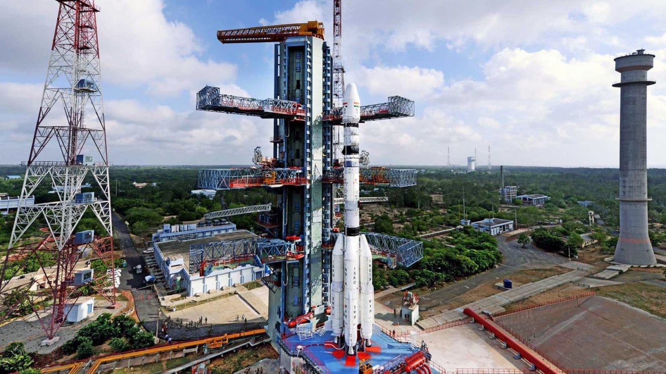
    India is planning to launch Geosynchronous Satellite Launch Vehicle (GSLV) Mark-III, the country’s most powerful rocket, in June.

    The rocket is capable of transporting a heavier 4 ton (3,628.7 kg) communications satellite and described as a game-changer in the first-of-its-kind space mission.

    With this rocket, the Indian Space Research Organisation (Isro) is aiming for a greater share of the multi-billion dollar global space market and to reduce dependency on international launching vehicles.

    A successful launch of this rocket will be another major step towards being self-reliant in the country’s space program.

    The Isro currently has the capability to launch payloads of up to 2.2 tonnes into the intended orbit and for anything above that it had to tap foreign launch facilities.

    “GSLV Mark-III is our next launch. We are getting ready. All the systems are in Sriharikota. The integration is currently going on,” Isro chairman A S Kiran Kumar said.

    GSLV Mark-III will be India’s most powerful launch vehicle built to lift the heaviest Indian communications satellites to space. Its 4 ton capacity is double the weight that the current GSLV-Mark-II can lift.

    It will also enable Isro to launch from India heavier communications spacecraft to geostationary orbits of 36,000 km. Because of the absence of a powerful launcher, Isro currently launches satellites above 2 tons on European rockets for a big fee.

    Noting that communications satellites built beyond the capacity of 2.2 tons have to be launched from foreign soil, Kiran Kumar said efforts are on to launch satellites up to four tonnes and even beyond in India itself.

    The GSLV Mark-III is intended to launch satellites into geostationary orbit and as a launcher for an Indian crew vehicle. It features an Indian cryogenic third stage and a higher payload capacity than the current GSLV.

  • Indonesia launches Telkom 3S satellite successfully

    Indonesia launches Telkom 3S satellite successfully

    The Indonesia’s biggest telecommunication company Telekomunikasi Indonesia (Telkom) has successfully launched its Telkom 3S satellite from Arianespace’s spaceport in Kourou, French Guiana, at 6.39 p.m. on February 14 local time or Wednesday at 4.39 am Jakarta time.

    The US$215 million worth satellite carries 24 C-band, eight extended C-band, and 10 Ku-band transponders, which intends to provide high-definition television services, faster mobile communications and Internet applications across the sprawling archipelago of over than 17,000 islands.

    “With Telkom 3S, Telkom will have a total of three satellites. The launching intends to increase the coverage since Telkom 1 and Telkom 2 has the same coverage with Telkom 3S. The reason is that our capacity is not enough; we still rent [transponders] from other countries,” Telkom’s president director Alex J. Sinaga said.

    Telkom 3S will first travel to 135.5 degrees east for testing purposes; then it will reach the final orbital position at 118 degrees east. The US$215 billion worth satellite is fitted with 24 C-band, eight extended C-band and 10 Ku-band transponders.

    Alex said that it would take ten days from the satellite launched until it could reach 135.5 degrees orbital position for testing purposes. After that, the spacecraft would be moved one degree a day to reach its fixed orbital position at 118 degrees east, he added.

    Top executives from PT Telekomunikasi Indonesia including president director Alex J. Sinaga (center), chief technology officer Abdus Somad Arief (second from right) and satellite project head Tonda Priyanto (right) pose after the successful launch of Telkom 3S on Tuesday. The satellite was launched according to plan at 6.39 p.m. from Kourou, French Guiana.(JP/Winny Tang)

    Arianespace has successfully orbited two satellites: Telkom 3s for Telkom Indonesia, together with SKY Brasil-1 for the operator AT&T/ DirectTV.

    “Arianespace is delighted to announce that SKY Brasil-1 and Telkom 3s have been separated as planned on the targeted geostationary orbit,” Stéphane Israël is the Chairman and CEO of Arianespace said in the satellite viewing site named Jupiter control room on Tuesday night local time.

    Replacing the position of Telkom 2, the Telkom 3S, which has a lifespan of 15 years, will cover Indonesia and a part of neighboring Malaysia.

    Apart from Indonesia, other countries, such as Brazil, Mexico and other South American countries, have also launched their satellites from the country.

  • Telkom’s $250m satellite to better connect Indonesia’s islands

    Telkom’s $250m satellite to better connect Indonesia’s islands

    Close to the equator, French Guiana, a scarcely populated country with only 158,000 inhabitants, is regarded as an ideal place to launch satellites. Mostly covered by equatorial forest, the South American country provides a stable climate, as well as invulnerability to earthquakes and hurricanes. Lying just over 500 km north of the equator, Kourou provides an advantage for satellite launches, because the earth’s spinning boosts the propulsion of the rocket taking the satellite into space.

    In this part of Guiana, where a joint French and European spaceport has been built, Indonesia’s biggest telecommunication company Telekomunikasi Indonesia (Telkom) is set to release its latest satellite into space early in the morning of Feb. 15, Jakarta time. Called the Telkom 3S, the firm’s third satellite, which costs up to Rp 3.33 trillion (US$250 million), will provide high-definition television services, faster mobile communications and internet applications across the sprawling Indonesian archipelago of more than 17,000 islands, reaching primarily to the most remote areas.

    This will be enabled by new technology, high-frequency Kuband transponders, which will cut installation time and allow faster connections.

    “Unlike Telkom 1 and Telkom 2 Telkom 3S has Ku-band. The benefit is that the dishes needed to receive signals are smaller,” Telkom satellite project head Tonda Priyanto said on Sunday in Kourou.

    Indonesia has long struggled with poor information and communication technology infrastructure despite the fact that many of its citizens are already highly tech-savvy.

    The current administration kicked off late last year its ambitious Palapa Ring project in a bid to connect all areas nationwide through its fiber-optic network.

    However, only around one third of Indonesia’s area can be covered by terrestrial communications systems, leaving the rest to be linked through satellite systems.

    A McKinsey report released last September revealed that Indonesia could realize growth of an estimated 10 percent in the gross domestic product (GDP), equivalent to $150 billion, by 2025.

    “The need for satellite technology is absolute in Indonesia. Meanwhile, the supply is still low,” Telkom chief technology officer Abdus Somad Arief recently said.

    Overall, the Telkom 3S satellite will carry 49 transponders, adding to the 140 transponders that Telkom currently operates through its two orbiting satellites.

    Satellite builder Thales Alenia Space has handled the design, testing and in-orbit delivery of the satellite, while the satellite launch company Arianespace will be in charge of releasing the satellite into space.

    During the planned launch, Telkom 3S will be positioned at 118 degrees east, to replace Telkom 2. Telkom 2, which still has a life span of about four years, will be moved to another orbital position.

    In response to the satellite launch, Communications and Information Minister Rudiantara said the Telkom 3S satellite would definitely help meet the demand for better network quality in Indonesia.

    “I think that even if the government begins launching its own satellites, we will still be at a deficit even up to the year 2023,” he said. “What the government can do in the meantime is to give satellite lending rights to local companies to avoid dependence on foreign ones.”